mail_outline sales@mediastorehouse.com
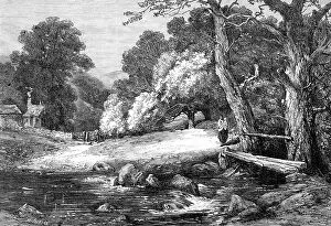
"The Combe Farm," by G. Chester, in the Royal Academy Exhibition, 1864. Creator: Mason Jackson"The Combe Farm," by G. Chester, in the Royal Academy Exhibition, 1864. Engraving of a painting. The "Combe," which is the subject of the admirably-painted landscape by Mr
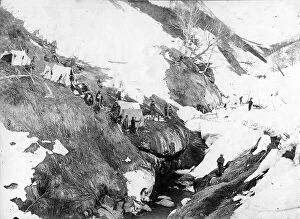
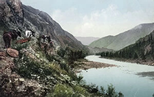
Expedition camp on the river bank, 1910-1929. Creator: Ivan Emelianovich LarinExpedition camp on the river bank, 1910-1929. From an album containing 296 works offering a glimpse of life in the Russian Far Northeast in the first third of the twentieth century
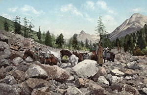
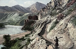
Path Along a Rock Field in the Valley of the Kuragan River, a Tributary of the Katun..., 1911-1913Path Along a Rock Field in the Valley of the Kuragan River, a Tributary of the Katun River; in the Vicinity of Belukha Mountain, 1911-1913
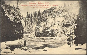
Baikal. A terrible ford on the Onote River, 180 versts from the village of Golumet, 1902. Creator: UnknownBaikal. A terrible ford on the Onote River, 180 versts from the village of Golumet, 1902. National Library of Russia
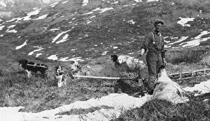
Caribou shot on the north side of Mt. McKinley and dog team ready to haul the meat to camp, 1912.
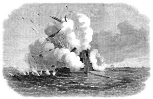
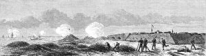
Experiments with the Armstrong 600-pounder against the Warrior floating target, 1864. Creator: UnknownExperiments with the Armstrong 600-pounder against the Warrior floating target, 1864. 'The sight presented by the target when struck was very grand
A Pack Road Along the Katun River near Its Confluence with the Argut River..., 1911-13A Pack Road Along the Katun River near Its Confluence with the Argut River. In the Vicinity of Iukhtener Mountain and Stream, 1911-1913
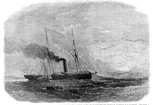
The War in America: the Federal steamer Chesapeake, seized by Confederates..., 1864. Creator: SmythThe War in America: the Federal steamer Chesapeake, seized by Confederates, landing crew and passengers off Musquash Harbour, Bay of Fundy, 1864. Engraving from a sketch by Mr. Charles C. Ward
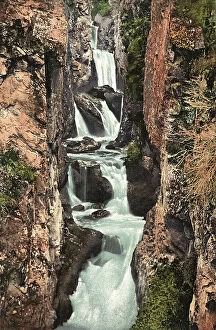
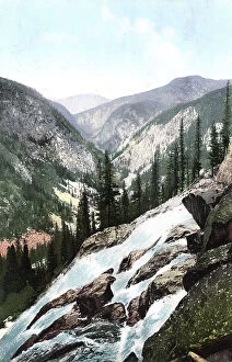
Cascade Waterfall near the Mouth of the Beltyr-Oek River, Left Tributary of the Katun..., 1911-1913Cascade Waterfall near the Mouth of the Beltyr-Oek River, Left Tributary of the Katun River, 1911-1913. From a collection of color postcards of the Altay, or Altai
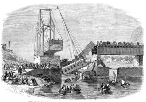
Scene of the disaster at Beloeil Bridge...Canada, 1864. Creator: UnknownScene of the disaster at Beloeil Bridge, near Montreal, on the Grand Trunk Railway of Canada, 1864. Engraving from a sketch
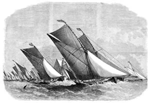
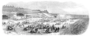
Sailing-barge race on the Thames, 1864. Creator: Edwin WeedonSailing-barge race on the Thames, 1864. 'A novel kind of sailing-match...was that which took place on the Thames, on Friday week under the auspices of the Prince of Wales Yacht Club
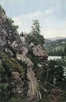
A Pack Road in the Katun River Valley near the Village of Tavda. Cliff "Skakun"..., 1911-1913A Pack Road in the Katun River Valley near the Village of Tavda. Cliff "Skakun." Log Boards for the Passage of Horses over the Precipice, 1911-1913
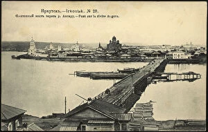
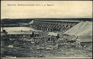
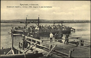
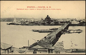
Irkutsk Pontoon bridge over the Angara River, 1904-1914. Creator: UnknownIrkutsk Pontoon bridge over the Angara River, 1904-1914. National Library of Russia
The Petroleum Oil Works at Franklin, Pennsylvania, 1864. Creator: UnknownThe Petroleum Oil Works at Franklin, Pennsylvania, 1864. In 1859. 'The apparatus to be seen at Oil Creek is of a simple description
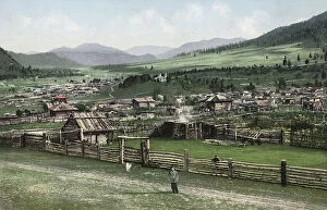
General View of the Village of Cherga, 1911-1913. Creator: Sergei Ivanovich BorisovGeneral View of the Village of Cherga, 1911-1913. From a collection of color postcards of the Altay, or Altai, Mountains region of southern Siberia early in the 20th century
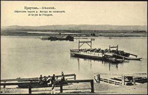
Irkutsk Crossing the Angara River on a boat, 1904-1914. Creator: UnknownIrkutsk Crossing the Angara River on a boat, 1904-1914. National Library of Russia
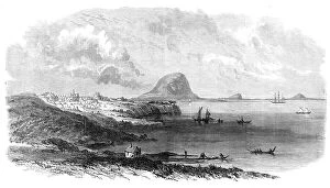
The War in New Zealand: Tauranga Harbour, with the camp of the head-quarters of the 68th..., 1864. Creator: UnknownThe War in New Zealand: Tauranga Harbour, with the camp of the head-quarters of the 68th and 43rd regiments, 1864. Engraving from a sketch by Colonel Carey of '...one of the finest natural havens
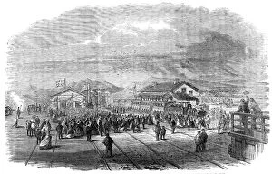
The Ramsgate Station of the East Kent (London, Chatham, and Dover) Railway, 1864. Creator: UnknownThe Ramsgate Station of the East Kent (London, Chatham, and Dover) Railway, 1864. 'View of the new station at...Ramsgate...recently built by Messrs. Peto and Betts from the designs of Mr
Laying concrete for the dam's sluice, Beloomut, 1912. Creator: Sergey Mikhaylovich Prokudin-GorskyLaying concrete for the dam's sluice, Beloomut, 1912. Workers and supervisors posing for photograph amid preparations for pouring cement for sluice dam foundation across the Oka River near
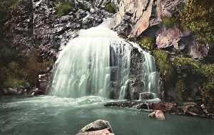
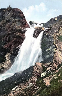
Kamyshlinsky Waterfall, located at the Confluence of the Kamyshla River...., 1911-1913Kamyshlinsky Waterfall, located at the Confluence of the Kamyshla River with the Katun River, 1911-1913. From a collection of color postcards of the Altay, or Altai
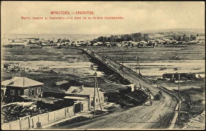
Irkutsk Railway bridge over the Irkut River, 1900-1904. Creator: UnknownIrkutsk Railway bridge over the Irkut River, 1900-1904. National Library of Russia
Dhurumsalla Churchyard, the burial-place of the late Viceroy of India, 1864. Creator: UnknownDhurumsalla Churchyard, the burial-place of the late Viceroy of India, 1864. Engraving from a photograph by Mr. G. D. Lyon
Rossypnaya Waterfall near the Source of the Katun River, ...Belukha Mountain, 1911-1913Rossypnaya Waterfall near the Source of the Katun River, the Vicinity of Belukha Mountain, 1911-1913. From a collection of color postcards of the Altay, or Altai
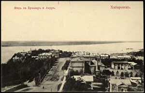
Khabarovsk. View of the Boulevard and Amur, 1904-1917. Creator: UnknownKhabarovsk. View of the Boulevard and Amur, 1904-1917. National Library of Russia
The War in America: Fort Fisher...the British steamer Hansa running the blockade..., 1864. Creator: Mason JacksonThe War in America: Fort Fisher, commanding the new inlet entrance to Cape Fear River - the British steamer Hansa running the blockade under the guns of the Fort, 1864
The Tarpeian Rock, Rome, 1864. Creator: Mason JacksonThe Tarpeian Rock, Rome, 1864. Engraving from a sketch by M. Mariani. 'This locality of sinister recollections is now only frequented by washer-women
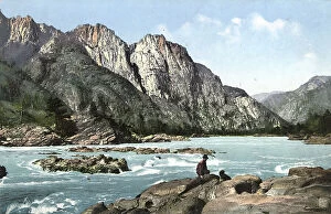
Manzherok Rapid on the Katun River, 1911-1913. Creator: Sergei Ivanovich BorisovManzherok Rapid on the Katun River, 1911-1913. From a collection of color postcards of the Altay, or Altai, Mountains region of southern Siberia early in the 20th century
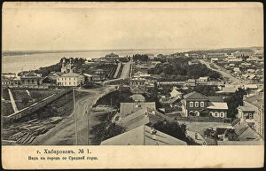
Khabarovsk. View of the city from Srednaya Gora, 1904. Creator: UnknownKhabarovsk. View of the city from Srednaya Gora, 1904. National Library of Russia
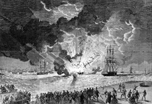
Explosion on board the barque Lottie Sleigh, laden with gunpowder, in the Mersey..., 1864. Creator: UnknownExplosion on board the barque Lottie Sleigh, laden with gunpowder, in the Mersey, as seen from the Cheshire side, 1864. Engraving from a sketch by Mr. Wood
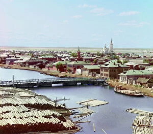
View of the city of Tobolsk from the north, from the bell tower of the Church..., 1912View of the city of Tobolsk from the north, from the bell tower of the Church of the Transfiguration, 1912. View of Tobol'sk from the Bell Tower of the Church of the Transfiguration
Rapid on the Katun River Above the Village of Chemal, 1911-1913. Creator: Sergei Ivanovich BorisovRapid on the Katun River Above the Village of Chemal, 1911-1913. From a collection of color postcards of the Altay, or Altai, Mountains region of southern Siberia early in the 20th century
The Dannewerk, Kur-Graben, and East Rampart...from a plan by Lieutenant-Colonel W. Dreyer..., 1864. Creator: UnknownThe Dannewerk, Kur-Graben, and East Rampart - from a plan by Lieutenant-Colonel W. Dreyer, taken in 1860, 1864. 'By reference to the accompanying Map it will be observed that the East Rampart is
Valley of the Katun River near the Village of Chemal, Teldekpen Rapid (Edigan Rapid), 1911-1913. From a collection of color postcards of the Altay, or Altai
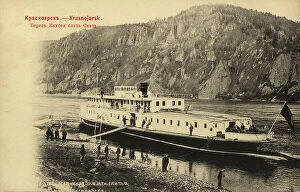
Krasnoyarsk The bank of the Yenisei near Skete, 1903. Creator: UnknownKrasnoyarsk The bank of the Yenisei near Skete, 1903. National Library of Russia
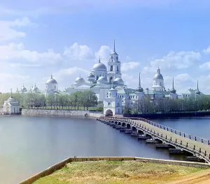
View of the monastery from Svetlitsa [Island, Saint Nil Stolbenskii Monastery, Lake Seliger], 1910. View of the Nilova Monastery. The Monastery of St
Valley of the Belaya-Berel River, a Tributary of the Bukhtarma River in the Vicinity of..., 1911-13Valley of the Belaya-Berel, a Tributary of the Bukhtarma River in the Vicinity of Belukha Mountain, 1911-1913. From a collection of color postcards of the Altay, or Altai
Irkutsk A pontoon across the Angara River, 1904-1914. Creator: UnknownIrkutsk A pontoon across the Angara River, 1904-1914. National Library of Russia
Opening of the Cape Town and Wellington Railway: arrival of the first train..., 1864. Creator: UnknownOpening of the Cape Town and Wellington Railway: arrival of the first train at Wellington Station, 1864. 'This is the only considerable railway undertaking begun in South Africa
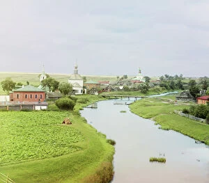
View of Suzdal along the Kamenka River, 1912. Creator: Sergey Mikhaylovich Prokudin-GorskyView of Suzdal along the Kamenka River, 1912. Stone churches, wooden houses, and a small bridge over the Kamenka River are photographed at the edge of the ancient Russian town of Suzdal'
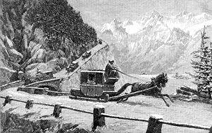
Descending Mont Cenis in Winter, 1864. Creator: UnknownDescending Mont Cenis in Winter, 1864. Travelling over the Alps by sleigh. '...tremendous faces of rock rise perpendicularly...there is a fearful precipice
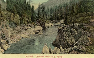
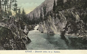
Valley of the Kumir River, a Tributary of the Charysh River; cliffs by the name..., 1911-1913Valley of the Kumir River, a Tributary of the Charysh River; cliffs by the name "Maiden Reach"., 1911-1913. From a collection of color postcards of the Altay, or Altai
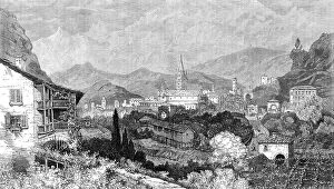
Susa, at the foot of Mont Cenis, 1864. Creator: Mason JacksonSusa, at the foot of Mont Cenis, [Italy], 1864. View of '...the point where the modem road crosses the old one. It shows the cathedral and the...three entrances into Italy; the ancient one
Irkutsk Pontoon bridge over the Angara River, 1902. Creator: UnknownIrkutsk Pontoon bridge over the Angara River, 1902. National Library of Russia
Valley of the Kumir River, a Tributary of the Charysh River; cliffs by the mame..., 1911-1913Valley of the Kumir River, a Tributary of the Charysh River; cliffs by the mame "Maiden Reach", 1911-1913. From a collection of color postcards of the Altay, or Altai
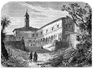
The Convent of St. Onofrio, near Rome, in which Tasso died, 1864. Creator: Mason JacksonThe Convent of St. Onofrio, near Rome, in which Tasso died, 1864. Engraving from a sketch by M. Mariani. 'The painful tale of the life and sufferings of Torquato Tasso
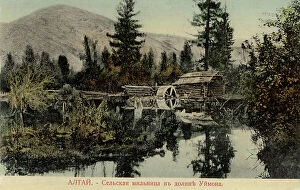
Water Mill in the Valley of the Uymon River, a Tributary of the Katun River, 1911-1913. From a collection of color postcards of the Altay, or Altai
Irkutsk Bridge over the Ushakovka River, 1900-1904. Creator: UnknownIrkutsk Bridge over the Ushakovka River, 1900-1904. National Library of Russia
Chuyskiy Tract, on the Slopes of Kyngrar Cliff above the Confluence of the Yaloman... 1911-1913Chuyskiy Tract, on the Slopes of Kyngrar Cliff above the Confluence of the Yaloman River into the Katun River, 1911-1913. From a collection of color postcards of the Altay, or Altai