mail_outline sales@mediastorehouse.com
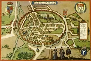
Plan of Canterbury in the Sixteenth Century, (1943). Creator: Frans HogenbergPlan of Canterbury in the Sixteenth Century, (1943). Map of the walled city of Cantuarbury in Kent, originally published c1580 by Georg Braun and Frans Hogenburg
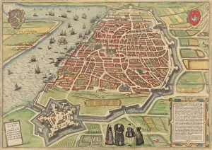
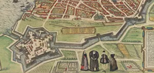
View of Antwerp, 1572-94. Creators: Frans Hogenberg, Simon NovellanusView of Antwerp, 1572-94. From Braun and Hogenbergs Civitates Orbis Terrarum
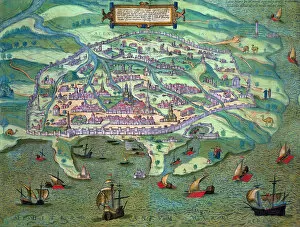
Map of Alexandria, 1575. Creators: Frans Hogenberg, Georg BraunMap of Alexandria, 1575
Palazzo Farnese at Caprarola, from Braun and Hogenbergs Civitates Orbis Terrarum, 1572-94
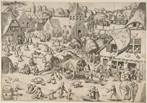
The Kermis at Hoboken, ca. 1559. Creator: Frans HogenbergThe Kermis at Hoboken, ca. 1559
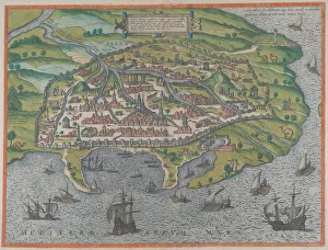
Map of Alexandria, Egypt, c1572. Artist: Joris HoefnagelMap of Alexandria, Egypt, c1572. From Civitates Orbis Terrarum by Georg Braun (1541-1622) and Frans Hogenberg (1535-90)
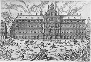
The Sack of Antwerp, 1576, (1903). Artist: Frans HogenbergThe Sack of Antwerp, 1576. (1903). The Sack of Antwerp, often known as the Spanish Fury at Antwerp, was an episode of the Eighty Years War. From Social England, Volume III, edited by H.D
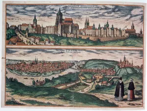
View of Prague, c1572. Artist: Joris HoefnagelView of Prague, c1572. A view of Prague, from Civitates Orbis Terrarum by Georg Braun (1541-1622) and Frans Hogenberg (1535-1590)