mail_outline sales@mediastorehouse.com
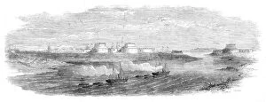
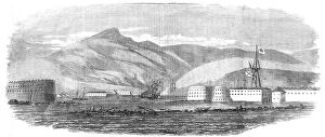
The War in China - the forts at the mouth of the Pehtang River, 1860. Creator: UnknownThe War in China - the forts at the mouth of the Pehtang River, 1860. British forces in the far east. The plan of operations decided upon was to land at the Pehtang River
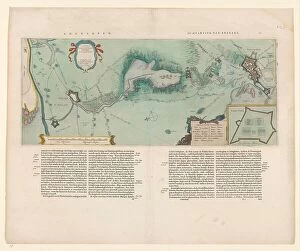
Map of the area between Bergen op Zoom and Steenbergen, 1630. Creator: Franciscus van SchootenMap of the area between Bergen op Zoom and Steenbergen, 1630. Tabula Bergarum ad Zomam Stenbergae'. Showing fortresses, trees, hills, harbours, areas susceptible to flooding
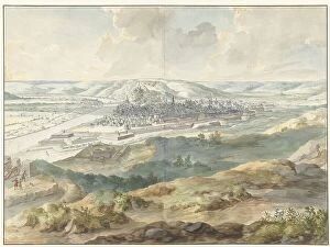
View of Namur from the East during the Siege of 1695, (1695). Creator: Dirk MaesView of Namur from the East during the Siege of 1695, (1695)
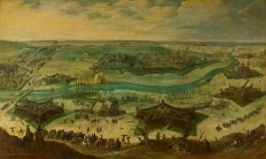
The Siege of Jülich, 1621-22, c.1635. Creator: Sebastian VrancxThe Siege of Julich, 1621-22, c.1635. Scene from the Eighty Years War. Attributed to Sebastiaen Vrancx
Reconnoitring at Cronstadt, 1854. Creator: UnknownReconnoitring at Cronstadt, 1854. Crimean War. Fort Peter I.; Fort Alexander; Fort Menschikoff; "Bulldog"; "Phlegethon"
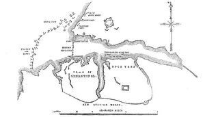
The Coast North of Sebastopol, and New Earth Batteries, 1854. Creator: UnknownThe Coast North of Sebastopol, and New Earth Batteries, 1854. Crimean War. Map of the strategic Black Sea port, ...sketched on board H.M.S
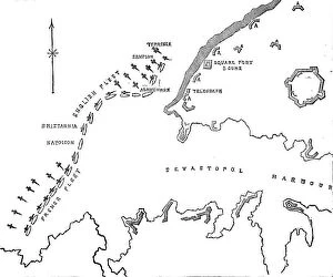
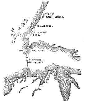
New Russian Works, 1854. Creator: UnknownNew Russian Works, 1854. Crimean War. Map showing the besieged Black Sea port of Sebastopol. English, French and Turkish ships are ranged across the entrance to the harbour
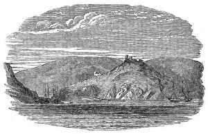
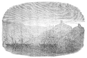
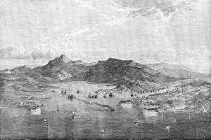
Entrance to Balaclava Harbour, 1854. Creator: UnknownEntrance to Balaclava Harbour, 1854. Crimean War. The town of Balaclava is situated close to the harbour, along the foot of the mountain, but it is not provided with good water
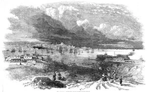
Balaclava - view inside the port, 1854. Creator: UnknownBalaclava - view inside the port, 1854. Crimean War. View of the'...inside of the port, which is only accessible through a very narrow circuitous channel, in the form of the letter S
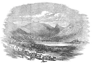
Balaclava Harbour, 1854. Creator: UnknownBalaclava Harbour, 1854. Crimean War....Balaclava has been completely changed into a Greek town...[It] is situated close to the harbour, along the foot of the mountain
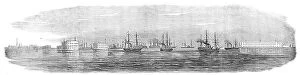
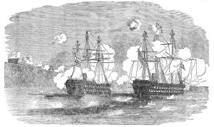
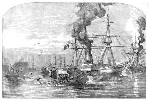
The "Agamemnon" and "Sanspareil" attacking Sebastopol, 1854. Creator: UnknownThe "Agamemnon" and "Sanspareil" attacking Sebastopol, 1854. Crimean War: Royal Navy ships....the Agamemnon...opened fire from her large pivot gun on the "Wasp" Fort
Sebastopol, sketched from Fort Constantine, 1854. Creator: UnknownSebastopol, sketched from Fort Constantine, 1854. Crimean War: strategic port on the Black Sea under siege. [British commander] Lord Raglan, it is said, received a few days ago
The Sunken Ships at the Mouth of the Harbour of Sebastopol, sketched by Lieut. Montagu... 1854. Creator: UnknownThe Sunken Ships at the Mouth of the Harbour of Sebastopol, sketched by Lieut. Montagu O'Reilly, H.M.S. Retribution, 1854. Crimean War
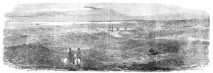
British Outposts, near Sebastopol, 1854. Creator: UnknownBritish Outposts, near Sebastopol, 1854. Crimean War: panorama showing Cossacks; Fort; English Steamer; Russian Soldiers Camp Cooking Houses
Sebastopol - from an original drawing, 1854. Creator: Edmund EvansSebastopol - from an original drawing, 1854. Crimean War. Warships on the Black Sea near the port of Sebastopol. The Siege of Sevastopol was the subject of Crimean soldier Leo Tolstoy's
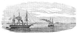
Steam-ships of the Allied Fleet searching for Infernal Machines off Cronstadt... 1854. Creator: UnknownSteam-ships of the Allied Fleet searching for Infernal Machines off Cronstadt - from a sketch by W.O. Brierly, 1854. Crimean War
Steam-ships reconnoitring at Sveaborg, in the Gulf of Finland, 1854. Creator: UnknownSteam-ships reconnoitring at Sveaborg, in the Gulf of Finland, 1854. Crimean War: Royal Navy ships off Russian-held Sveaborg [modern Suomenlinna]
Plan of the Attack at 5.30pm, when these were almost exclusively the Ships engaged with the... 1854 Creator: UnknownPlan of the Attack at 5.30pm, when these were almost exclusively the Ships engaged with the Forts, 1854. Crimean War. Map showing the besieged Black Sea port of Sebastopol