Edinburgh Geographical Institute Collection (page 2)
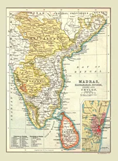
Map of Madras, Hyderabad, Mysore, Coorg and Ceylon, 1902. Creator: Unknown
Map of Madras, Hyderabad, Mysore, Coorg and Ceylon, 1902. From The Century Atlas of the World. [John Walker & Co, Ltd. London, 1902]
All Professionally Made to Order for Quick Shipping