mail_outline sales@mediastorehouse.com
The Isle of Anglesey, The Isle of Man and the Isle of Wight, 1650, (1946). Creator: UnknownThe Isle of Anglesey, The Isle of Man and the Isle of Wight, 1650, (1946). Three maps of islands off the coast of Britain
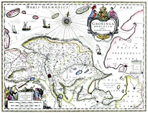
Map of Groningen, Netherlands, 17th century. A map of the Dutch province of Groningen, published by Willem Blaeu after the original design by Barthold Wicheringe
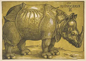
The Rhinoceros, after 1620. Creator: Albrecht DurerThe Rhinoceros, after 1620
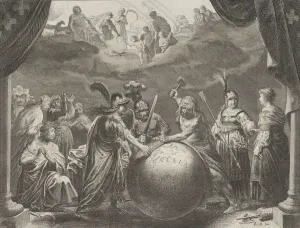
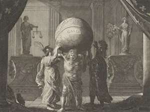
Plate 12: Allegory on the Discord in France, from Caspar Barlaeus, " Medicea Hospes", 1638
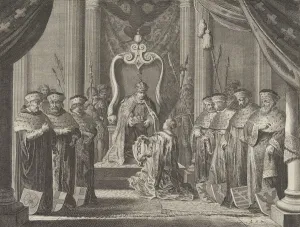
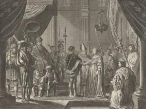
Plate 8: Emperor Maximilian II granting a crown to the coat of arms of Amsterdam, from Caspar Barlaeus, " Medicea Hospes", 1638
Plate 13: Allegory on the Discord in France, from Caspar Barlaeus, " Medicea Hospes", 1638
Plate 7: The Marriage of Francisco I de Medici and Johanna of Austria, from Caspar Barlaeus, " Medicea Hospes", 1638
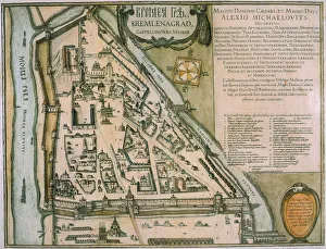
The Moscow Kremlin Map of the 16th century (Castellum Urbis Moskvae), ca. 1600. Creator: BlaeuThe Moscow Kremlin Map of the 16th century (Castellum Urbis Moskvae), ca. 1600. Private Collection
An orrery designed by the Danish astronomer Tycho Brahe, c1630. Artist: Joan BlaeuAn orrery designed by the Danish astronomer Tycho Brahe, c1630. From the Atlas Major by Johann Blaeu
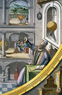
Tycho Brahe, Danish astronomer, (c1630). Artist: Joan BlaeuTycho Brahe, Danish astronomer, (c1630). Brahe (1546-1601) aged 40, amongst his astonomical instuments. From the Atlas Major by Johann Blaeu
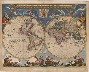
Double hemisphere map of the World, 1662. Artist: Blaeu, Joan (1596-1673)Double hemisphere map of the World, 1662. Private Collection
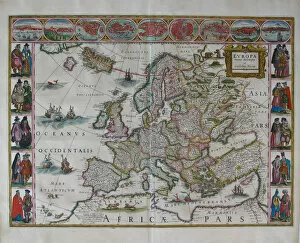
Europe Map (From: Atlas Maior). Artist: Blaeu, Joan (1596-1673)Europe Map (From: Atlas Maior). Private Collection
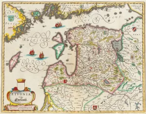
Livonia Map, Vulgo Lyefland, Atlas Maior. Artist: Blaeu, Joan (1596-1673)Livonia Map, Vulgo Lyefland, Atlas Maior. Private Collection
Double hemisphere map of the World. Artist: Blaeu, Joan (1596-1673)Double hemisphere map of the World. Private Collection
Rugen (From: Theatrum Orbis Terrarum... ), 1645. Artist: Blaeu, Willem Janszoon (1571-1638)Rugen (From: Theatrum Orbis Terrarum...), 1645. Found in the collection of the UCLA Library
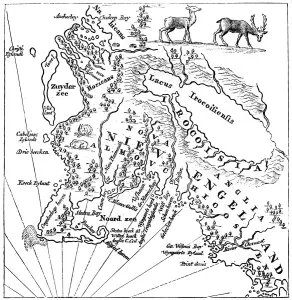
New England in 1660, (c1880). From Blaeus Theatre du Monde. In this curious map the north is at the bottom and the south at the top
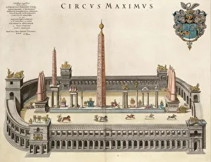
The Circus Maximus (From the Atlas Van Loon). Artist: Blaeu, Joan (1596-1673)The Circus Maximus (From the Atlas Van Loon). Private Collection
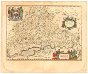
Map of Russia (From: Theatrum Orbis Terrarum... ), 1645. Artist: Blaeu, Willem Janszoon (1571-1638)Map of Russia (From: Theatrum Orbis Terrarum...), 1645. From a private collection
Map of Russia and Moscow (From: Theatrum Orbis Terrarum... ), 1645. Artist: Blaeu, Willem Janszoon (1571-1638)Map of Russia and Moscow (From: Theatrum Orbis Terrarum...), 1645. From a private collection
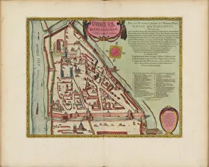
Map of the Moscow Kremlin (Castellum Urbis Moskvae), Russia, 1597. Artist: Willem BlaeuMap of the Moscow Kremlin (Castellum Urbis Moskvae), Russia, 1597. Found in the collection the State Museum of History, Moscow
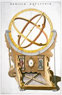
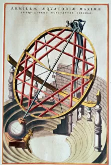
The equatorial armillary of Tycho Brahe, 16th century. Artist: Joan BlaeuThe equatorial armillary of Tycho Brahe (14 December 1546 - 24 October 1601), from Joan Blaeus Le Grand Atlas. Brahe built this on the island of Huen to measure celestial latitude and longitude