mail_outline sales@mediastorehouse.com
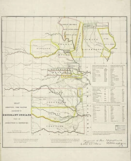
Map showing the lands assigned to emigrant Indians west of Arkansas and Missouri, 1836. Creator: Topographical BureauMap showing the lands assigned to emigrant Indians west of Arkansas and Missouri, 1836. Following passage of the Indian Removal Act in 1830
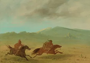
An Osage Indian Pursuing a Camanchee, 1861 / 1869. Creator: George CatlinAn Osage Indian Pursuing a Camanchee, 1861/1869. Arkansaw. 1836
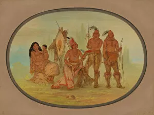
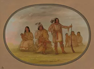
Osage Indians, 1861 / 1869. Creator: George CatlinOsage Indians, 1861/1869. Cler-mont (chief with club), Wa-chee-te (his wife) and two warriors Mun-ne-pus-kee and Nah-com-e-sah on the River Arkansaw. 1836
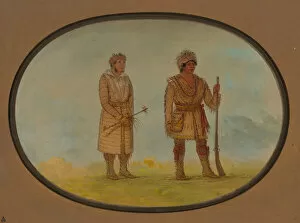
Two Cherokee Chiefs, 1861 / 1869. Creator: George CatlinTwo Cherokee Chiefs, 1861/1869. Jol-lee (half-caste and civilised chief) and Tuch-ee (celebrated frontier Indian) ransported by President Jackson from Georgia to the Upper Arkansaw. 1836
Osceola and Four Seminolee Indians, 1861 / 1869. Creator: George CatlinOsceola and Four Seminolee Indians, 1861/1869. Os-ce-o-la (celebrated half-caste chief) with Mick-e-no-pa (head chief) and his wife How-e-da-hee
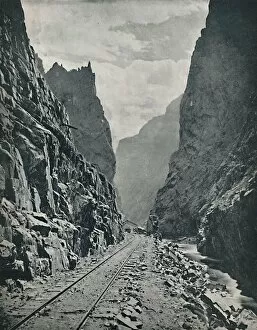
Royal Gorge of the Arkansas, c1897. Creator: UnknownRoyal Gorge of the Arkansas, c1897. Royal Gorge is a canyon of the Arkansas River located in Colorados Rocky Mountain region which fell under Spanish claims
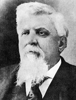
Judge Isaac C Parker, the Hanging Judge, in his later years, c1890s (1954). Previously a Missouri congressman, Parker was appointed District Judge for the Western District of Arkansas in 1875 at a
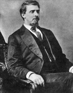
Judge Isaac C Parker, the Hanging Judge, c1870s-1880s (1954)Judge Isaac C Parker, the Hanging Judge, 1874 (1954). Previously a Missouri congressman, Parker was appointed District Judge for the Western District of Arkansas in 1875 at a time of great
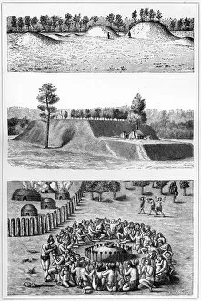
Native American archaeological sites, USA, 1901. The Avondale Mounds, Washington County, Mississippi; De Soto Mound, Jefferson County, Arkansas, and a small mound from Le Moynes Brevis Narratio