mail_outline sales@mediastorehouse.com
Picnic grounds at Lemont, Ill's. between 1900 and 1905. Creator: UnknownPicnic grounds at Lemont, Ill's. between 1900 and 1905
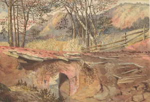
In the Red Clay Region, 19th century. Creator: UnknownIn the Red Clay Region, 19th century
City dragon, 2007. Creator: Ethel DaviesModel of the dragon signifying the entrance to the City of London, a separate administrative area within London, with its own mayor and police force, near Trinity Square, London, EC3, England
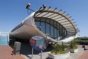
Caridff, Tourist Info Centre, 2009. Creator: Ethel DaviesThe Tourist Information Centre in Cardiff Bay, a plywood pod designed by Will Alsop that offers information on the redeveloped area of Cardiff Bay, Cardiff, Wales, UK
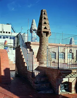
Perspective of the chimneys in the west area of the Güell Palace 1886-1890Perspective of the chimneys in the west area of the Guell Palace 1886-1890, designed by Antoni Gaudi i Cornet
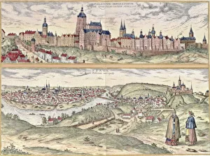
View of Prague, representing the Imperial Palace or Hradschin in the upper part and the town with the Moldava river separating the old part of the modern in the lower part
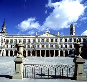
New Square and City Hall of Vitoria, portico area designed by Justo de Olaguibel
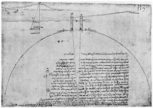
Method of measuring the surface of the Earth, late 15th or early 16th century (1954). Artist: Leonardo da VinciMethod of measuring the surface of the Earth, late 15th or early 16th century (1954). Codex Atlanticus, 269v-a. A print from Leonardo da Vinci by Ludwig H Heydenreich. (London, 1954)
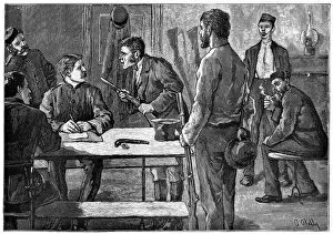
Surrendering arms in a proclaimed district, Ireland. Artist: O KellySurrendering arms in a proclaimed district, Ireland