mail_outline sales@mediastorehouse.com
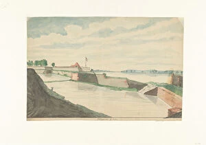
Cranganore Fort at Cochin, 1785. Creator: Jan BrandesCranganore Fort at Cochin, 1785. View of the Dutch Fort Kranganoor (Cranganur, modern usage: Kodungallur) near Cochin in South India. Fortress and ruins in a bay or river mouth
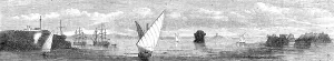
The Persian Expedition - Minora Point and Lighthouse, Kurrachee Harbour, Oyster Rock... 1857. Creator: UnknownThe Persian Expedition - Minora Point and Lighthouse, Kurrachee [Karachi] Harbour, Oyster Rock, Church and Town of Kurrachee, Oyster Rocks, 1857
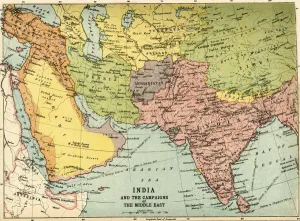
India and the Campaigns of the Middle East, First World War, 1914-1918, (c1920). Map showing British India coloured pink as part of the British Empire, Afghanistan, Persia, Asia Minor, Arabia
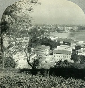
The Great City of Bombay, the Metropolis of Western India, from Malabar Hill, c1930s. View of Chowpatty beach from Malabar Hill, a residential neighbourhood in Mumbai, Maharashtra on the Arabian Sea
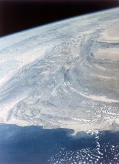
India-Pakistan boundary seen from aboard the second Space Shuttle flight, November 1981. The border between India and Pakistan stretches from the Arabian Sea to the foothills of the Himalayan
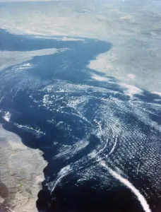
Earth from space - the Gulf of Oman and Strait of Hormuz, second Space Shuttle flight, 1981. The Gulf of Oman is a strait which connects the Arabian Sea with the Strait of Hormuz
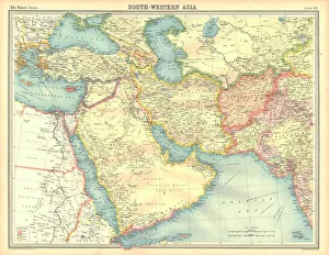
Political map of South Western Asia. Map of the Near and Middle East, showing parts of East Africa and the Arabian Peninsula. Plate 50 from The Times Atlas
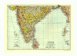
Map of India Southern part, c1910. Artist: Johann Georg Justus PerthesMap of India South, c1910. [Encyclopaedia Britannica Co]
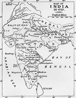
Map of India in 1757, (c1912). From The Romance of India, edited by Herbert Strang. [Hodder & Stoughton, London, c1912]
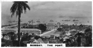
The port, Bombay, India, c1925. View of what is now Mumbai. Cigarette card produced by the Westminster Tobacco Co Ltd, Indian Empire, 1st series