mail_outline sales@mediastorehouse.com
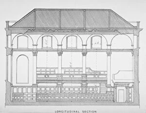
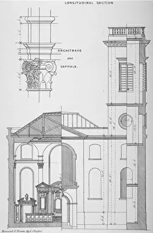
Longitudinal section of the Church of St Clement, Eastcheap, City of London, 1860
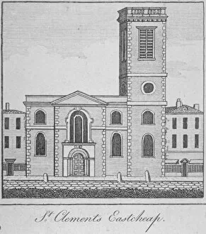
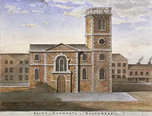
West view of the Church of St Clement, Eastcheap, City of London, 1750
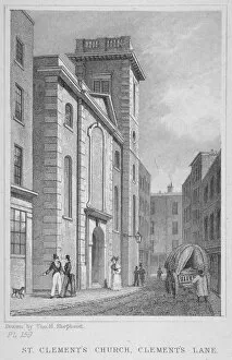
Church of St Clement, Eastcheap, City of London, 1831. Street scene with figures and a cart
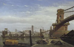
Hungerford Pier and Footbridge, c1850. Passengers disembarking from steamboats tied up in mid-stream at Hungerford Pier and ascending by stairs to footbridge level
Church of St Clement, Eastcheap, City of London, 1860. Cross sectional drawing of St Clement, Eastcheap with detail of a column architrave
South view of the Church of St Clement, Eastcheap, City of London, 1820
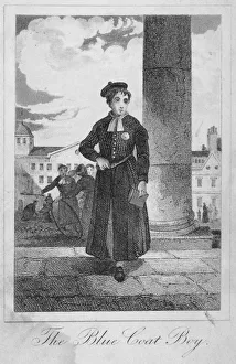
Pupil of Christs Hospital, City of London, 1829. Pupil of Christs Hospital with other students and school buildings in the background
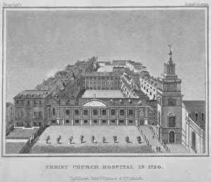
Bird s-eye view of Christs Hospital as it was in 1720, City of London, 1829. ArtistBird s-eye view of Christs Hospital as it was in 1720, City of London, 1829
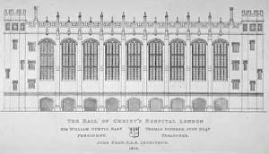
Elevation of the hall of Christs Hospital, City of London, 1825
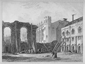
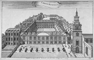
West view of Christs Hospital, with ruins of some of the old buildings, City of London, 1825
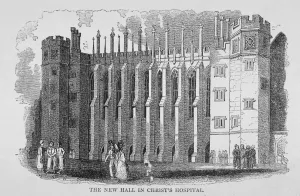
View of the hall, Christs Hospital, City of London, 1830
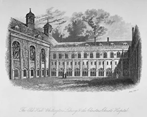
The Old Hall, Whittingtons Library and the cloisters, Christs Hospital, City of London, 1825
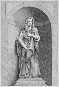
Statue of Sir John Moore from Christs Hospital, City of London, 1770. Sir John Moore (1620-1702) was Lord Mayor of London in 1681-1682 and President of Christs Hospital from 1686-1687 and 1688-1702
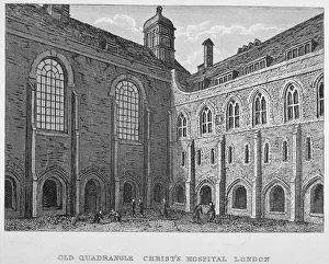
View of the old quadrangle, Christs Hospital, City of London, 1823
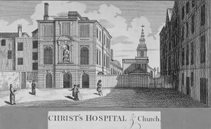
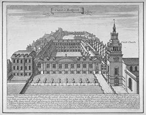
Christs Hospital with Christ Church in the background, City of London, 1750. ArtistChrists Hospital with Christ Church in the background, City of London, 1750
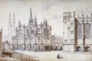
Christ Church, school hall and proposed new building, Christs Hospital, City of London, 1870
Christs Hospital, City of London, 1755. Artist: Benjamin ColeChrists Hospital, City of London, 1755
Christs Hospital, City of London, 1700. With a description beneath
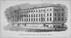
A View of Charlotte Row, near the Mansion House, City of London, 1820
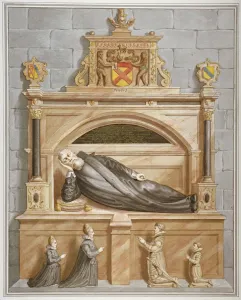
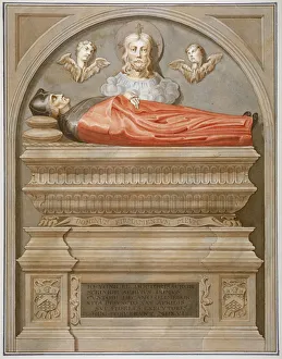
Monument to Sir Edward Bruce in Rolls Chapel, Chancery Lane, City of London, 1794. Edward Bruce, 1st Lord Kinloss, was a lawyer and judge who served as Master of the Rolls from 1603 until 1611
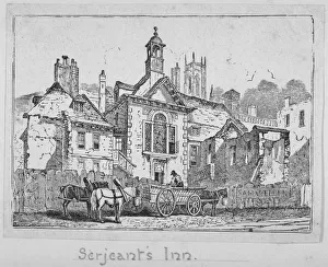
View of Serjeants Inn with a horse and cart, Chancery Lane, City of London, 1840
Monument to Dr John Yonge by Torrigiano in Rolls Chapel, Chancery Lane, City of London, 1800. Yonge (1467-1516) was an ecclesiastic and diplomatist who was appointed Master of the Rolls in 1507
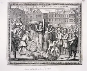
The execution of John Bradford and John Leaf at Smithfield, 1555, (c1713). The execution took place during the Protestants persecution in the reign of Mary I
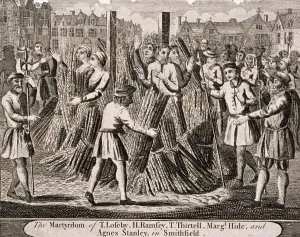
Execution of protestants at Smithfield, 1557, (c1720). The execution of T Loseby, H Ramsey, T Thirtell, Margaret Hide and Agnes Stanley
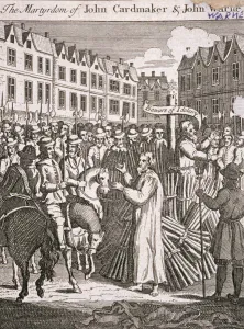
The execution of John Cardmaker and John Warne at Smithfield, 1555, (c1725). ArtistThe execution of John Cardmaker and John Warne at Smithfield, 1555, (c1725). The execution took place during the Protestants persecution in the reign of Mary I
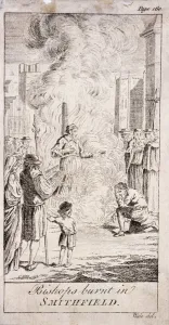
Protestant bishops being burnt at Smithfield, during the reign of Mary I, 16th century, (c1760)Protestant bishops being burnt at Smithfield, during the reign of Mary I in the 16th century, (c1760)
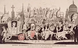
Queen Elizabeth I travelling by coach to St Pauls after the defeat of the Spanish Armada, c1840Queen Elizabeth I travelling by coach to St Pauls Cathedral after the defeat of the Spanish Armada, c1840
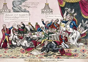
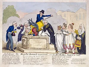
Alderman Sir Matthew Wood and King George IVThe Modern Belshazzers Feast; Alderman Sir Matthew Wood presents an envelope marked the Queens letter to the Prince Regents dinner table which falls into disarray
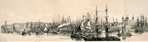
Panoramic view of London, c1851View of the north bank of the River Thames from the south bank of the river looking towards the Tower of London on the right, 1851. With boats on the River Thames
Scene at Horse Guards Parade, London, 1816. The Prince Regent (later King George IV) is portrayed as the mortar known as the Regents Bomb
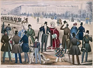
Regents Park, Marylebone, London, 1840View in Regents Park, London showing figures wearing winter fashions for 1840 and 1841. A troop of soldiers, possibly Household Cavalry, parade down the street on horseback
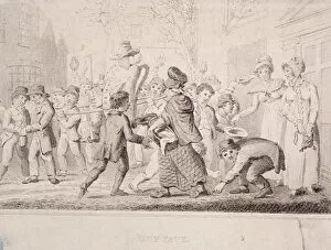
Children collecting pennies for the Guy, 1816
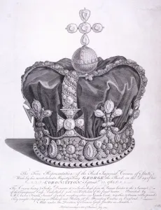
Imperial crown of state worn by King George III on his coronation, 1763
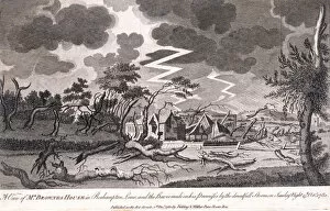
Lewis Browns house during the storm on the night of 15th October, Roehampton, 1780. The scene shows storm clouds and lightning along with the destruction caused to the house and lands
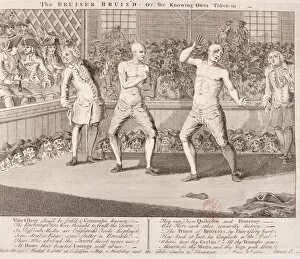
The Bruiser Bruis d, 1750; showing James Broughton and another fighter at Marylebone Fields, which were notorious for violence at this time. The lower margin contains verse
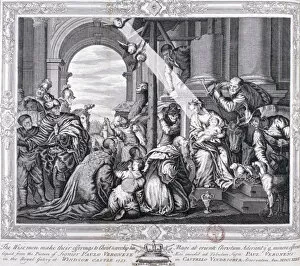
The Three Wise Men make their offerings to Christ and worship him, 1733
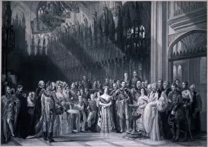
Christening of Edward VII, 1842Scene of the christening of the Prince of Wales later King Edward VII in St Georges Chapel, Windsor Castle, Berkshire, 1842
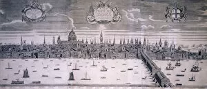
City of London, c1710View of the City of London from the south bank of the River Thames, c1710; with the City arms in the top right
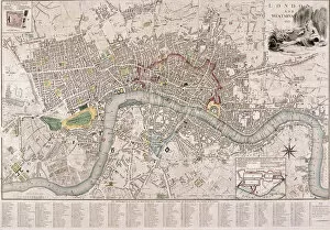
Map of London, 1798. Map of the City of Westminster, City of London, River Thames, Lambeth, Southwark and surrounding areas, 1798. Top left view shows St Jamess Palace
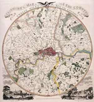
Map of London, 1798. Artist: E BourneMap of twelve mile area around London, 1798. Bottom left view shows Chelsea Hospital and bottom right view shows Greenwich Hospital
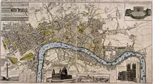
Map of London, 1797. Artist: Edward MoggMap of London, 1797. Map of the City of London, City of Westminster, River Thames, Lambeth, Southwark and surrounding areas, 1797. The city walls are shown in red
Map of London, 1789 representing Elizabethan LondonView of the Cities of London and Westminster in the reign of Elizabeth I, 1558-1603
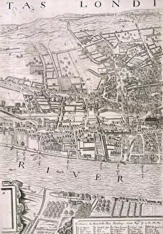
Map of London, 1560. Artist: George VertueMap of London in the year 1560; showing the area between the end of the Strand and St Pauls Cathedral, with Southwark to the south of the River Thames and part of a key below
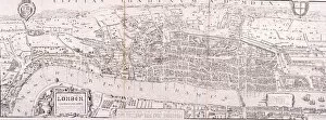
Map of London, c1560Map of London c1560 during the reign of Queen Elizabeth I, 1558-1603
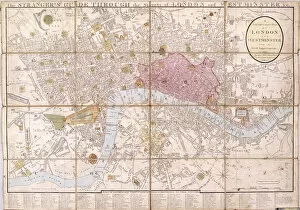
Map of London, 1823Map of the City of London, City of Westminster, River Thames, Lambeth, Southwark and surrounding areas, 1823
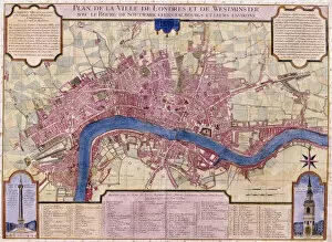
Map of London, 1727. French map of the City of London, City of Westminster, River Thames, Lambeth, Southwark and surrounding areas
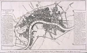
Map of London showing English Civil War Fortifications, c1642, (c1750). Plan of the City of London and surrounding area showing fortifications erected during the English Civil War, c1642
Map of LondonUpper panel shows the City of London from Southwark before the Great Fire of London in 1666; middle panel shows the same view after the Great Fire