mail_outline sales@mediastorehouse.com
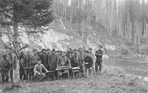
Topographers, Members of the Land-Management Expedition, 1913. Creator: GI IvanovTopographers, Members of the Land-Management Expedition at the Table with a Group of Shoria Men, 1913. From a collection of 109 photographs taken during a 1913 topographic expedition to the Gornaia
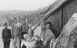
G.I. Ivanov and a Shoria Family at the Table with Samovar Near the Tent, 1913. Creator: GI IvanovG.I. Ivanov and a Shoria Family at the Table with Samovar Near the Tent, 1913. From a collection of 109 photographs taken during a 1913 topographic expedition to the Gornaia Shoria in the Altai
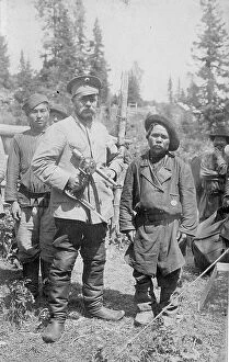
Topographer, a Member of the Land-Management Expedition with the Village Headman, 1913. Creator: GI IvanovTopographer, a Member of the Land-Management Expedition with the Village Headman, 1913. From a collection of 109 photographs taken during a 1913 topographic expedition to the Gornaia Shoria in
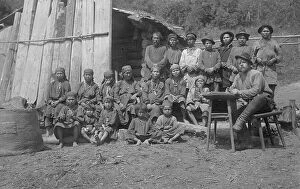
Inhabitants of One Gornaia Shoria Village and an Expedition Member, 1913. Creator: GI IvanovInhabitants of One Gornaia Shoria Village and an Expedition Member; making a List of All Home Owners, 1913. From a collection of 109 photographs taken during a 1913 topographic expedition to
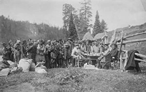
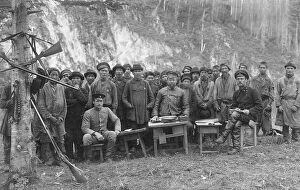
Group of Shoria Men with Members of the Land-Management Expedition, 1913. Creator: GI IvanovGroup of Shoria Men with Members of the Land-Management Expedition on the Shore - Gornaia Shoria Ulus Gathering, 1913. From a collection of 109 photographs taken during a 1913 topographic expedition
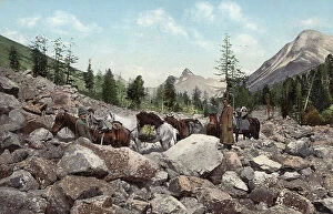
Path Along a Rock Field in the Valley of the Kuragan River, a Tributary of the Katun... 1911-1913Path Along a Rock Field in the Valley of the Kuragan River, a Tributary of the Katun River; in the Vicinity of Belukha Mountain, 1911-1913
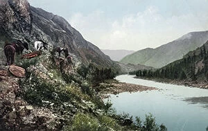
A Pack Road Along the Katun River near Its Confluence with the Argut River... 1911-13A Pack Road Along the Katun River near Its Confluence with the Argut River. In the Vicinity of Iukhtener Mountain and Stream, 1911-1913
Manzherok Rapid on the Katun River, 1911-1913. Creator: Sergei Ivanovich BorisovManzherok Rapid on the Katun River, 1911-1913. From a collection of color postcards of the Altay, or Altai, Mountains region of southern Siberia early in the 20th century
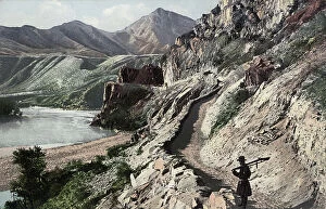
Chuyskiy Tract, on the Slopes of Kyngrar Cliff above the Confluence of the Yaloman... 1911-1913Chuyskiy Tract, on the Slopes of Kyngrar Cliff above the Confluence of the Yaloman River into the Katun River, 1911-1913. From a collection of color postcards of the Altay, or Altai
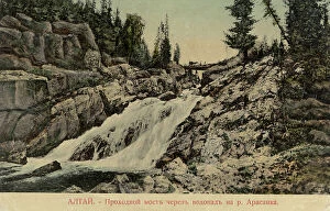
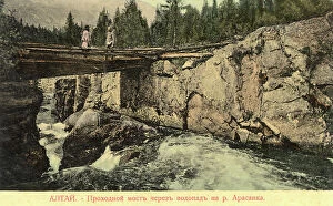
Bridge Across a Waterfall on the Arasan River, 1911-1913. Creator: Sergei Ivanovich BorisovBridge Across a Waterfall on the Arasan River, 1911-1913. From a collection of color postcards of the Altay, or Altai, Mountains region of southern Siberia early in the 20th century
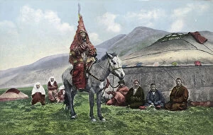
Kazakh Woman in Wedding Clothes on a Horse, 1911-1913. Creator: Sergei Ivanovich BorisovKazakh Woman in Wedding Clothes on a Horse, 1911-1913. From a collection of color postcards of the Altay, or Altai, Mountains region of southern Siberia early in the 20th century
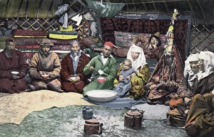
Inside a Kazakh Yurt, 1911-1913. Creator: Sergei Ivanovich BorisovInside a Kazakh Yurt, 1911-1913. From a collection of color postcards of the Altay, or Altai, Mountains region of southern Siberia early in the 20th century
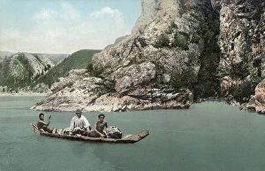
Crossing the Katun River on a Dugout Canoe near Dzhir-Bom, Above the Mouth of the Chui... 1911-13Crossing the Katun River on a Dugout Canoe near Dzhir-Bom, Above the Mouth of the Chui River, 1911-1913. From a collection of color postcards of the Altay, or Altai
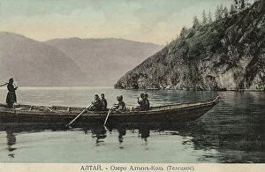
Boat on Lake Teletskoye, 1911-1913. Creator: Sergei Ivanovich BorisovBoat on Lake Teletskoye, 1911-1913. From a collection of color postcards of the Altay, or Altai, Mountains region of southern Siberia early in the 20th century
On the bank of the Katun River near the village of Tavdy, 1895. Creator: Vasilii Vasilevich SapozhnikovOn the bank of the Katun River near the village of Tavdy, 1895. From a collection of 60 photos by V.V. Sapozhnikov (1861-1924), a geographer, botanist, ethnographer
Map of the Altai Region from the Office of His Majesty, 1914. Creator: Resettlement Department of the Land RegulationMap of the Altai Region from the Office of His Majesty, 1914. From the atlas "Atlas of Asian Russia."
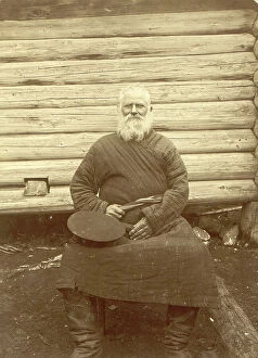
Old Man, 1909. Creator: Nikolai Georgievich KatanaevOld Man, 1909. This image is from Tipy kazakov: Sibirskie kazaki na sluzhbe i doma (Types of Cossacks: Siberian Cossacks on duty and at home), one of three albums depicting the territories, culture
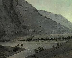
Crossing Over the River Katun Above Angudaia. View From the North. Altai, 1850-1899. From a collection of paintings, lithographs, sketches, studies, and drawings
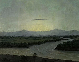
Source of the River Ob'. Altai, 1850-1899. Creator: Pavel Mikhailovich KosharovSource of the River Ob'. Altai, 1850-1899. From a collection of paintings, lithographs, sketches, studies, and drawings, which capture various remote corners of the Siberian wilderness
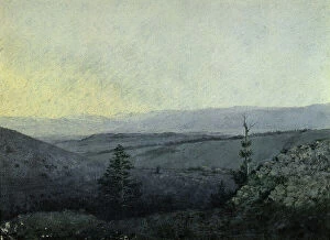
Mountain Landscape. Altai, 1850-1899. Creator: Pavel Mikhailovich KosharovMountain Landscape. Altai, 1850-1899. From a collection of paintings, lithographs, sketches, studies, and drawings, which capture various remote corners of the Siberian wilderness
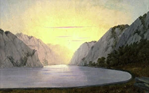
View of Lake Teletskoye. Altai, 1850-1899. Creator: Pavel Mikhailovich KosharovView of Lake Teletskoye. Altai, 1850-1899. From a collection of paintings, lithographs, sketches, studies, and drawings, which capture various remote corners of the Siberian wilderness
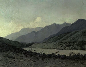
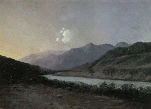
Source of the Katun River Altai, 1880-1897. Creator: Pavel Mikhailovich KosharovSource of the Katun River Altai, 1880-1897. From a collection of paintings, lithographs, sketches, studies, and drawings, which capture various remote corners of the Siberian wilderness
View From the Armankoi Mountain to the South-East Kuraiskaya Heights Altai, 1880-1897. From a collection of paintings, lithographs, sketches, studies, and drawings
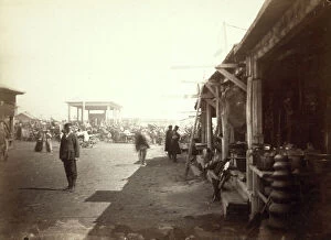
Bazar [ie, bazaar] or market place at Barnaoul [ie, Barnaul], between 1885 and 1886. Creator: UnknownBazar [ie, bazaar] or market place at Barnaoul [ie, Barnaul], between 1885 and 1886