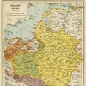
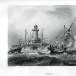
Poland and the Partitions of 1772, 1793 & 1795, (c1920). Creator: John Bartholomew & Son
. Creator: John Bartholomew & Son")
![]()
Wall Art and Photo Gifts from Heritage Images
Poland and the Partitions of 1772, 1793 & 1795, (c1920). Creator: John Bartholomew & Son
Poland and the Partitions of 1772, 1793 & 1795, (c1920). Map showing how territory in Europe was divided between the empires of Russia, Prussia and Austria in the 18th century. From " The Great World War - A History" Volume IV, edited by Frank A Mumby. [The Gresham Publishing Company Ltd, London, c1920]
Media ID 19174401
© The Print Collector/Heritage Images
Austro Hungarian Empire Baltic Sea Bartholomew Bartholomew And Co Bartholomew Co Bartholomew John Son Commonwealth Disputed Territory Frank Arthur Frank Arthur Mumby Galicia Gresham Publishing Co Ltd Gresham Publishing Company Imperial Imperialism Jg Bartholomew John And Son John Bartholomew And Co John Bartholomew And Son John Bartholomew And Son Ltd John Bartholomew Co John Bartholomew Son John Bartholomew Son Ltd John Son Keystone Archives Lithuania Mumby Mumby Frank Arthur Occupied Territory Partition Poland Prussia Prussian Territorial Territory The Great World War A History Theatre Of War Ukraine
MADE IN THE UK
Safe Shipping with 30 Day Money Back Guarantee
FREE PERSONALISATION*
We are proud to offer a range of customisation features including Personalised Captions, Color Filters and Picture Zoom Tools
SECURE PAYMENTS
We happily accept a wide range of payment options so you can pay for the things you need in the way that is most convenient for you
* Options may vary by product and licensing agreement. Zoomed Pictures can be adjusted in the Basket.