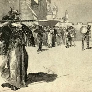
Map of the Vikings & Western Christendom in the Ninth Century, (1935)
")
![]()
Wall Art and Photo Gifts from Heritage Images
Map of the Vikings & Western Christendom in the Ninth Century, (1935)
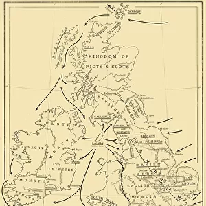
Map of the Vikings & Western Christendom in the Ninth Century, (1935). Modern map showing territories occupied, controlled or raided by the Vikings (roughly 793-1066 AD). From A History of the Anglo-Saxons, Vol. II, by R. H. Hodgkin. [The Clarendon Press, Oxford, 1935]
Media ID 15466510
© The Print Collector / Heritage-Images
9th Century Anglo Saxon Colonisation Frank Frankish Invasion Scandinavia Territorial Territory Viking Vikings
MADE IN THE UK
Safe Shipping with 30 Day Money Back Guarantee
FREE PERSONALISATION*
We are proud to offer a range of customisation features including Personalised Captions, Color Filters and Picture Zoom Tools
SECURE PAYMENTS
We happily accept a wide range of payment options so you can pay for the things you need in the way that is most convenient for you
* Options may vary by product and licensing agreement. Zoomed Pictures can be adjusted in the Basket.