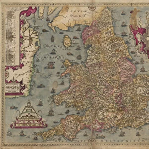
Map of Scotland, 1902. Creator: Unknown

![]()
Wall Art and Photo Gifts from Heritage Images
Map of Scotland, 1902. Creator: Unknown
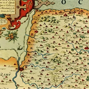
Map of Scotland, 1902. Showing the various counties and islands including the Hebrides, the Shetlands and the Orkneys, and an inset of the rail networks of Glasgow and Edinburgh. From The Century Atlas of the World. [John Walker & Co, Ltd. London, 1902]
Media ID 15512564
© The Print Collector / Heritage-Images
Counties County Edinburgh Geographical Institute Hebrides Orkney Islands Orkneys Shetland Islands
MADE IN THE UK
Safe Shipping with 30 Day Money Back Guarantee
FREE PERSONALISATION*
We are proud to offer a range of customisation features including Personalised Captions, Color Filters and Picture Zoom Tools
SECURE PAYMENTS
We happily accept a wide range of payment options so you can pay for the things you need in the way that is most convenient for you
* Options may vary by product and licensing agreement. Zoomed Pictures can be adjusted in the Basket.