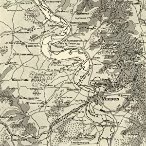
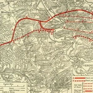
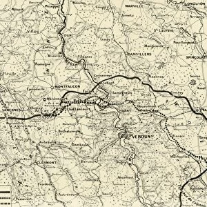
Map illustrating the Operations at Verdun, First World War, August-November, 1917, (c1920)
")
![]()
Wall Art and Photo Gifts from Heritage Images
Map illustrating the Operations at Verdun, First World War, August-November, 1917, (c1920)
Map illustrating the Operations at Verdun, First World War, August-November, 1917, (c1920). Map of the area around the town of Verdun in northern France, showing Line from which the French started, and Line reached by the French as the result of General [Adolphe] Guillaumats actions. From " The Great World War: A History", Volume VII, edited by Frank A Mumby. [The Gresham Publishing Company Ltd, London, c1920]
Media ID 19665935
© The Print Collector/Heritage Images
Frank A Frank A Mumby Frank Arthur Frank Arthur Mumby Front Line Frontline Gresham Publishing Co Ltd Gresham Publishing Company Keystone Archives Lines Lorraine Meuse Mumby Mumby Frank A Mumby Frank Arthur Position Positions The Great World War A History Theatre Of War Verdun Verdun Meuse Lorraine France Western Front
MADE IN THE UK
Safe Shipping with 30 Day Money Back Guarantee
FREE PERSONALISATION*
We are proud to offer a range of customisation features including Personalised Captions, Color Filters and Picture Zoom Tools
SECURE PAYMENTS
We happily accept a wide range of payment options so you can pay for the things you need in the way that is most convenient for you
* Options may vary by product and licensing agreement. Zoomed Pictures can be adjusted in the Basket.