mail_outline sales@mediastorehouse.com
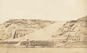
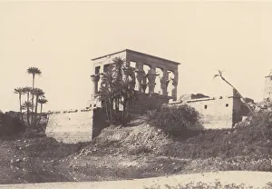
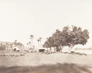
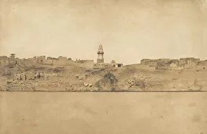
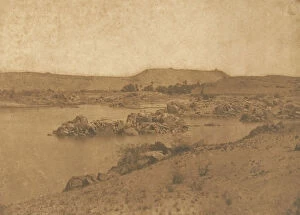
Vue generale des Speos de Phre et d Athor, a Abousembil, prise de l ile, March 29, 1850
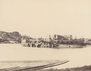
Vue prise du Nord-Est de Philae - Village de Kolokina, 1849-50. Creator: Maxime du CampVue prise du Nord-Est de Philae - Village de Kolokina, 1849-50
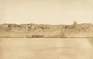
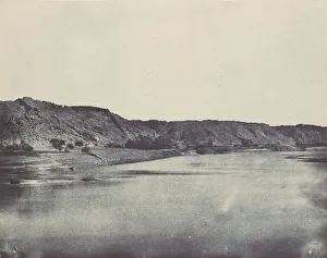
Vue generale d Esne (No. 1 extremite Sud), 1849-50
Nubie. Vue Cavaliere de la Seconde Cataracte, 1850. Creator: Maxime du CampNubie. Vue Cavaliere de la Seconde Cataracte, 1850
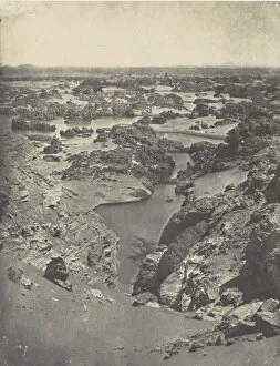
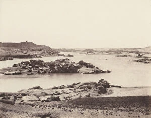
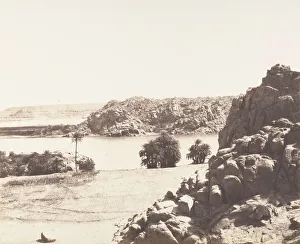
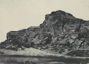
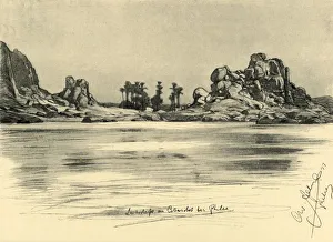
Vue cavaliere de la seconde cataracte, prise du haut de Djebel-Aboucir, March 24, 1850
Ile de Fileh (Philae), edifice de l Est - Vue GenéIle de Fileh (Philae), edifice de l Est - Vue Generale Prise du Point C, 1851-52, printed 1853-54
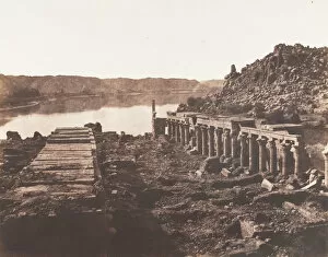
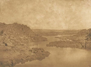
Premiere Cataracte, Montagnes Granitiques Couvertes de Sables, 1851-52, printed 1853-54
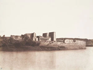
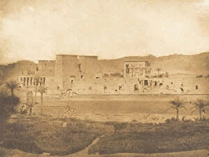
Ile de Fileh (Philae), Vue Generale Prise du Sud-Est au Point B, 1851-52, printed 1853-54
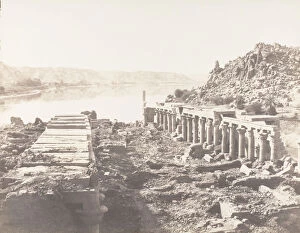
Premiere Cataracte, Vue Generale Prise de la Point MéPremiere Cataracte, Vue Generale Prise de la Point Meridionale de l Ile d elephantine, 1851-52, printed 1853-54
Korosko, Sycomores et Campement d une Caravane pour le Sennar, 1851-52, printed 1853-54
Ile de Fileh (Philae), Vue Generale Prise du Point I, Sur La Plateforme du Pylone, 1851-52, printed 1853-54
Esneh, Dattiers, Sycomore et Cafe Sur le Bord du Nil, 1851-52, printed 1853-54
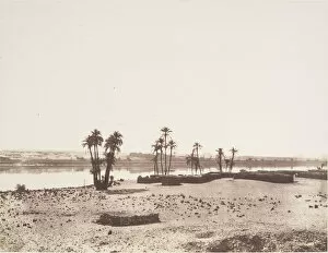
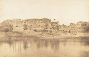
Dakkeh, Village et Rives du Nil, 1851-52. Creator: Felix TeynardDakkeh, Village et Rives du Nil, 1851-52
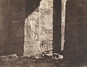
Ile de Fileh (Philae), Premier Pylone, Inscription Francaise GravéIle de Fileh (Philae), Premier Pylone, Inscription Francaise Gravee Sur L ebrasement Oriental, En M, 1851-52
Tafah, Rochers Granitiques sur les Rives du Nil, 1851-52, printed 1853-54
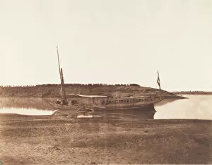
Louksor, Petit Bras du Nil - Barque de Voyageurs, 1851-52. Creator: Felix TeynardLouksor, Petit Bras du Nil - Barque de Voyageurs, 1851-52
Ile de Fileh (Philae), Vue Generale Prise du Point I, Sur La Plateforme du Pylone, 1851-52
Ile de Fileh (Philae), Vu Generale Prise du Nord-Ouest au Point A, 1851-52
Vue generale d Esne (No. 2, partie mediale), 1849-50
Nubie. Seconde Cataracte. Dgebel-Abouoir, 1850. Creator: Maxime du CampNubie. Seconde Cataracte. Dgebel-Abouoir, 1850
Vue generale de l ile de Philae, prise de l Est, 1849-50
Vue generale de l ile de Philae, prise de l ile de Begueh (Ouest), 1849-50
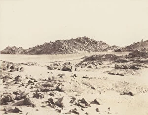
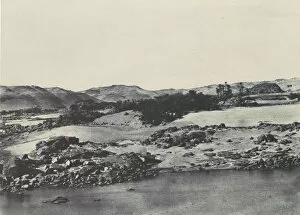
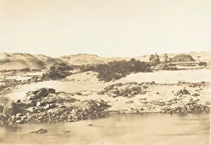
Haute-egypte. Entree de la premiere Cataracte, 1850
Sortie de la premiere Cataracte (cote S. E. ), 1849-50Sortie de la premiere Cataracte (cote S.E.), 1849-50
Entree de la premiere Cataracte pres d Assouan, 1849-50
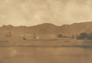
Nubie. Rive Orientale du Nil (Village de Bab). Vue prise au sud de Philoe, 1850
Vue de la premiere Cataracte, prise a l Ouest, entre Assouan et Philae, 1849-50
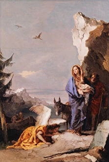
The Flight into Egypt, ca. 1767-70. Creator: Giovanni Battista TiepoloThe Flight into Egypt, ca. 1767-70
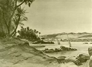
First Cataract near the Island of Philae on the River Nile, Egypt, 1898. CreatorFirst Cataract near the Island of Philae on the River Nile, Egypt, 1898. Landschaft an Cataractes bei Philae. From " Rund um die Erde" [Round the Earth], written and illustrated by C. W
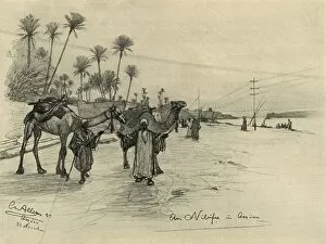
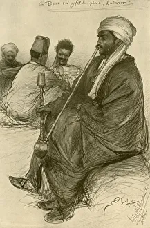
Camel-drivers on the banks of the Nile at Aswan, Egypt, 1898. Creator: Christian Wilhelm AllersCamel-drivers on the banks of the Nile at Aswan, Egypt, 1898. Am Nilufer um Assuan. From " Rund um die Erde" [Round the Earth], written and illustrated by C. W. Allers
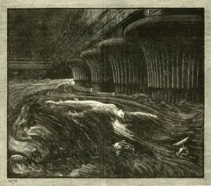
Storm from the north on the River Nile, Egypt, 1898. Creator: Christian Wilhelm AllersStorm from the north on the River Nile, Egypt, 1898. A felucca sails in rough waters as palm trees bend in the wind. Nordsturm am Nil
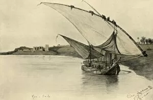
Felucca on the Nile at Kom Ombo, Egypt, 1898. Creator: Christian Wilhelm AllersFelucca on the Nile at Kom Ombo, Egypt, 1898. Men climbing the rigging on a cargo boat near the Temple of Kom Ombo. Kom-Ombo
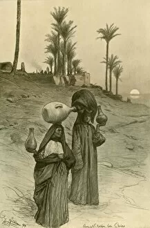
Women carrying water pots on the banks of the Nile, Cairo, Egypt, 1898. Am Nilufer bei Cairo. From " Rund um die Erde" [Round the Earth], written and illustrated by C. W. Allers
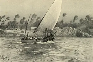
Man smoking a water pipe on board the Hatasoo steamboat, Egypt, 1898. The Hatasoo was a passenger paddle steamer on the River Nile, built in 1890. Am Bord der Nildampfer Hatasoo
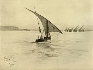
Feluccas on the River Nile, Egypt, 1898. Creator: Christian Wilhelm AllersFeluccas on the River Nile, Egypt, 1898. From " Rund um die Erde", by C. W. Allers. [Union Deutsche Verlagsgesellschaft, Stuttgart, 1898]
Feluccas on the River Nile, Cairo, Egypt, 1898. Creator: Christian Wilhelm AllersFeluccas on the River Nile, Cairo, Egypt, 1898. From " Rund um die Erde", by C. W. Allers. [Union Deutsche Verlagsgesellschaft, Stuttgart, 1898]
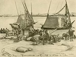
Loading cotton onto grain boats, River Nile, Cairo, Egypt, 1898. Baumwollhandler vor Kornschiffe am Nilufer bei Cairo. From " Rund um die Erde", by C. W. Allers
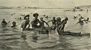
Men in the River Nile at the First Cataract, Egypt, 1898. Creator: Christian Wilhelm AllersMen in the River Nile at the First Cataract, Egypt, 1898. Locals in the water near the Island of Philae. Am Katarakt. From " Rund um die Erde" [Round the Earth]
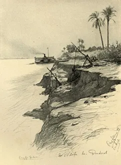
On the banks of the Nile at Dendera, Egypt, 1898. Creator: Christian Wilhelm AllersOn the banks of the Nile at Dendera, Egypt, 1898. Paddle steamer Hatasoo on the River Nile. On the right is a shadoof, a device for lifting water for irrigation. Am Nilufer bei Denderah
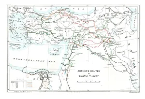
Authors Routes in Asiatic Turkey, c1915. Creator: Stanfords Geographical EstablishmentAuthors Routes in Asiatic Turkey, c1915. Map showing the journeys of British writer, soldier and diplomatic advisor Mark Sykes (1879-1919) who travelled through Palestine, Iraq, Syria
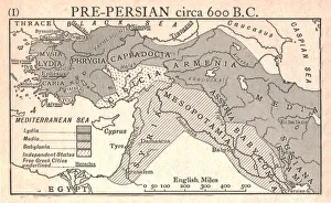
Pre-Persian, circa 600 B. C. c1915. Creator: Emery Walker LtdPre-Persian, circa 600 B.C. c1915. Map of the eastern Mediterranean and near East, showing the ancient civilisations of empires of Lydia, Media, Babylonia, Independent States, and free Greek cities
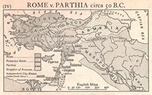
Rome v. Parthia, circa 50 B. C. c1915. Creator: Emery Walker LtdRome v. Parthia, circa 50 B.C. c1915. Map of the eastern Mediterranean and Near East, showing the ancient empires of Rome, Parthia, Armenia, and Protected and Independent States
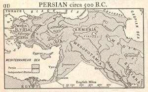
Persian, circa 500 B. C. c1915. Creator: Emery Walker LtdPersian, circa 500 B.C. c1915. Map of the eastern Mediterranean and Near East, showing the ancient Persian empire and Independent States
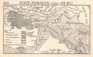
Post-Persian, circa 188 B. C. c1915. Creator: Emery Walker LtdPost-Persian, circa 188 B.C. c1915. Map of the eastern Mediterranean and Near East, showing the ancient empires of Pergamum, Seleucid, Free Greek States, Gauls, Ptolemy, and Independent States
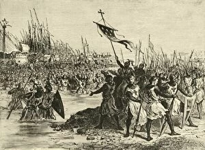
Louis IX. Landing In Egypt, (1249), 1890. Creator: UnknownLouis IX. Landing In Egypt, (1249), 1890. Louis IX of France landed in 1249 at Damietta on the Nile during the Seventh Crusade 1248-1254, wher he was to be defeated by an Egyptian army
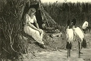
Anysis Concealed in the Marshes of the Delta, 1890. Creator: UnknownAnysis Concealed in the Marshes of the Delta, 1890. Anysis may have been Pharaoh Tefnakht, of the 24th dynasty, Third Intermediate Period
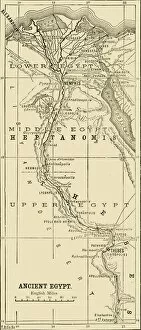
Map of Ancient Egypt, 1890. Creator: UnknownMap of Ancient Egypt, 1890. For almost 30 centuries from its unification around 3100 BC to its conquest by Alexander the Great in 332 BC
The Banquet of Nitocris, 1890. Creator: UnknownThe Banquet of Nitocris, 1890. Nitocris, 6th century BC Babylonian queen and last pharoah of the Sixth Dynasty, invited the murderers of her brother to a banquet