mail_outline sales@mediastorehouse.com
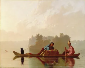
Fur Traders Descending the Missouri, 1845. Creator: George Caleb BinghamFur Traders Descending the Missouri, 1845
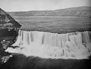
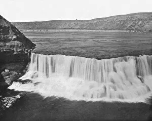
Missouri River, below Great Falls, Montana, c1897. Creator: UnknownMissouri River, below Great Falls, Montana, c1897. Named by William Clark of the Lewis and Clark Expedition in 1805, most water is now diverted to a hydroelectric plant at the Ryan Dam
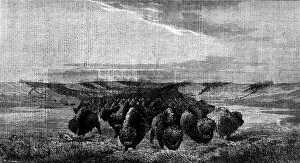
"A Herd of Bisons crossing a River Bottom on the Upper Missouri", by W. J. Hays, 1862. Creator: W Thomas"A Herd of Bisons crossing a River Bottom on the Upper Missouri", by W. J. Hays, 1862. Engraving of a painting. 'In crossing the richer pastures of the river bottoms the herd will
Str. Montana, between 1900 and 1914. Creator: UnknownStr. Montana, between 1900 and 1914
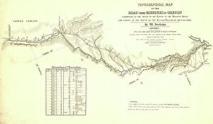
Topographical map of the road from Missouri to Oregon, commencing at the mouth of the Kansas...1846 CreatorsTopographical map of the road from Missouri to Oregon, commencing at the mouth of the Kansas in the Missouri River and ending at the mouth of the Walla-Wallah in the Columbia, 1846
Missouri River near Great Falls, Montana, USA, c1900. Creator: UnknownMissouri River near Great Falls, Montana, USA, c1900. Captain Meriwether Lewis and Second Lieutenant William Clark were the first white men to see the falls in 1805
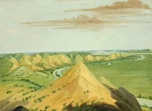
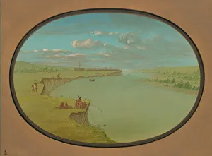
View in the Big Bend of the Upper Missouri, 1832. Creator: George CatlinView in the Big Bend of the Upper Missouri, 1832
Picturesque Bluffs above Prairie du Chien, 1835-1836. Creator: George CatlinPicturesque Bluffs above Prairie du Chien, 1835-1836
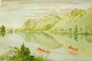
View on the Upper Mississippi, Beautiful Prairie Bluffs, 1835-1836
Catlin and His Men in Their Canoe, Urgently Solicited to Come Ashore, Upper Missouri, 1846-1848
Clay Bluffs, Twenty Miles above the Mandans, 1832. Creator: George CatlinClay Bluffs, Twenty Miles above the Mandans, 1832
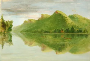
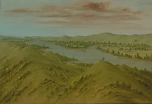
Grassy Bluffs, Upper Missouri, 1861 / 1869. Creator: George CatlinGrassy Bluffs, Upper Missouri, 1861/1869
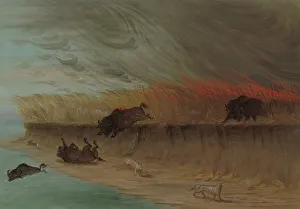
Prairie Meadows Burning, 1861 / 1869. Creator: George CatlinPrairie Meadows Burning, 1861/1869
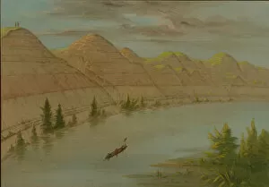
View in the "Grand Detour, "Upper Missouri, 1861 / 1869. Creator: George CatlinView in the " Grand Detour, " Upper Missouri, 1861/1869
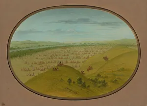
Mandan Village - A Distant View, 1861 / 1869. Creator: George CatlinMandan Village - A Distant View, 1861/1869. American Fur Companys trading fort
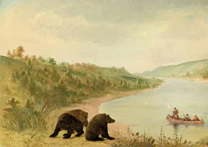
Fort Pierre, 1861 / 1869. Creator: George CatlinFort Pierre, 1861/1869. A trading post of the American Fur Company, at the mouth of Little Missouri, upper Missouri
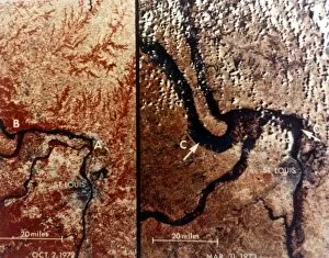
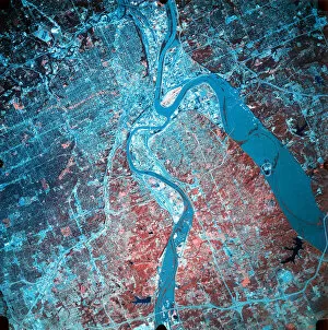
Earth from space - the Mississippi River and St Louis, USA, c1980s. Creator: NASAEarth from space - the Mississippi River and St Louis, USA, c1980s. Two views of the city of St Louis, Missouri, near the confluence of the Missouri and Mississippi rivers
Missouri River, below Great Falls, Montana, USA, c1900. Creator: UnknownMissouri River, below Great Falls, Montana, USA, c1900. Captain Meriwether Lewis and Second Lieutenant William Clark were the first white men to see the falls in 1805
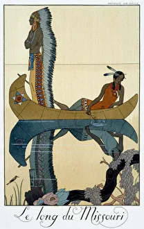
The Length of the Missouri, 1922. Artist: Georges BarbierThe Length of the Missouri, 1922. Pochoir print
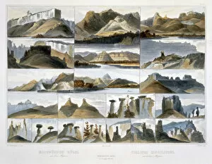
Remarkable Hills on the Upper Missouri, 1844. Artist: Friedrich SalatheRemarkable Hills on the Upper Missouri, 1844. Plate 35 from Volume 2 of Travels in the Interior of North America by Karl Bodmer
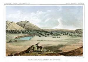
Milk River, Near Junction of Missouri, 1856. Artist: John Mix StanleyMilk River, Near Junction of Missouri, 1856. View of the Milk River near the junction of the Missouri River in Montana on August 18, 1853
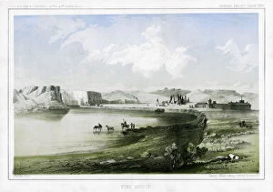
Fort Benton, Montana, USA, 1856. Artist: John Mix StanleyFort Benton, Montana, USA, 1856. Members of the Stevens United States Railroad Survey arrive at Fort Benton near the Great Bend of the Missouri River in North Central Montana
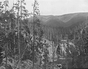
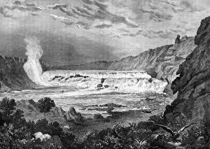
Grand Falls, Missouri River, USA, 19th century. Artist: Jules LaurensGrand Falls, Missouri River, USA, 19th century
Infrared photograph of the confluence of the Missouri and Kansas rivers, USA, 19 July 1993. The photograph was taken from NASAs ER-2 aircraft during a period of heavy flooding