mail_outline sales@mediastorehouse.com
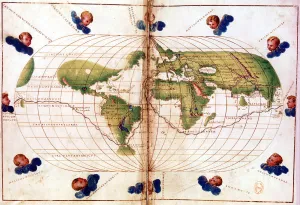
Map of Magellans round the world voyage, 1519-1521. A Portuguese-born navigator sponsored by Spain, Ferdinand Magellan (c1480-1521)
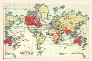
World Map showing the British Empire, 1902. Creator: UnknownWorld Map showing the British Empire, 1902. British possessions coloured red. From The Century Atlas of the World. [John Walker & Co, Ltd. London, 1902]
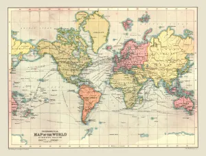
Commercial Map of the World, 1902. Creator: UnknownCommercial Map of the World, 1902. With shipping routes. From The Century Atlas of the World. [John Walker & Co, Ltd. London, 1902]
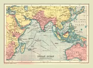
Map of the Indian Ocean, 1902. Creator: UnknownMap of the Indian Ocean, 1902. Showing the coast of East Africa, Arabia, the Indian subcontinent, the Far East and part of Australia. From The Century Atlas of the World. [John Walker & Co, Ltd
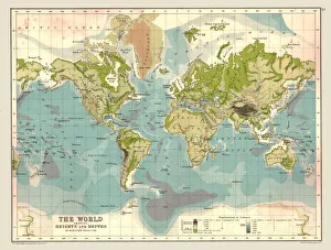
Map of the World showing Heights and Depths, 1902. Creator: UnknownMap of the World showing Heights and Depths, 1902. From The Century Atlas of the World. [John Walker & Co, Ltd. London, 1902]
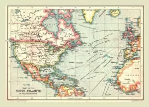
Chart of the North Atlantic, 1902. Creator: UnknownChart of the North Atlantic, 1902. Showing North and Central America, West Africa and Western Europe, and transatlantic shipping routes. From The Century Atlas of the World. [John Walker & Co, Ltd
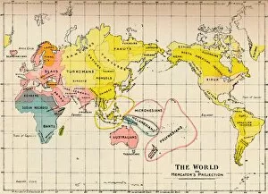
Map of the World on Mercators Projection, 1902Map - The World on Mercators Projection, 1902. From The Living Races of Mankind, Vol. I. [Hutchinson & Co, London, 1902]