mail_outline sales@mediastorehouse.com
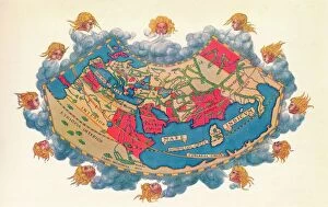
Ptolemys Map of the World cA. D 150. (1912) Artist: Claudius PtolemyPtolemys Map of the World cA.D 150. The Ptolemy world map is a map of the known world to Hellenistic society in the 2nd century AD
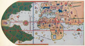
The First map to Show America, (1500) 1912The First map to Show America, 1500 (1912). After the map of Juan de la Cosa (c1450-1510), 1500. The map or chart is a mappa mundi painted on parchment
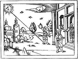
Measuring the altitude of the Sun, 1539. From Cosmographia by Peter Apian. (Antwerp, 1539)
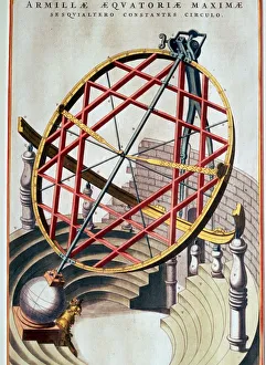
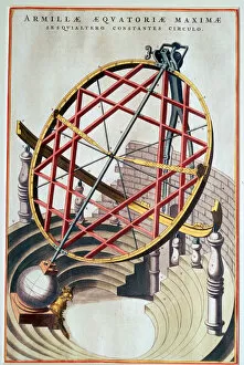
The Equatorial Armillary of Tycho Brahe, 17th centuryThe Equatorial Armillary of Tycho Brahe, built on the Danish isle of Huen to measure celestial latitude and longitude. This illustration is from Blaeus Le Grand Atlas of 1662
The equatorial armillary of Tycho Brahe, 16th century. Artist: Joan BlaeuThe equatorial armillary of Tycho Brahe (14 December 1546 - 24 October 1601), from Joan Blaeus Le Grand Atlas. Brahe built this on the island of Huen to measure celestial latitude and longitude