mail_outline sales@mediastorehouse.com
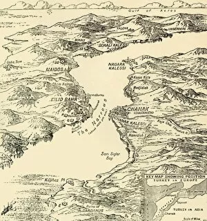
Map of the Dardanelles, First World War, 1915, (c1920). Creator: UnknownMap of the Dardanelles, First World War, 1915, (c1920). Bird s-eye View of the Dardanelles from the Entrance to the Straits to the Narrows
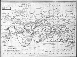
Map of the world showing sailing routes and telegraph cables, c1893. Artist: George Philip & Son LtdMap of the world showing sailing routes and telegraph cables, c1893. From Outlines of British Colonisation, by William Henry Parr Greswell
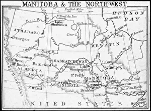
Map of Manitoba and the Northwest, Canada, c1893. Artist: George Philip & Son LtdMap of Manitoba and the Northwest, Canada, c1893. From Outlines of British Colonisation, by William Henry Parr Greswell
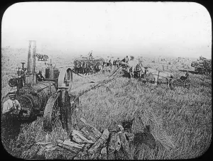
Harvest scene on the North American prairies, late 19th or early 20th century. Artist: George Philip & Son LtdHarvest scene on the North American prairies, late 19th or early 20th century. Lantern slide
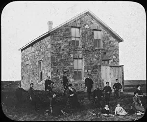
A settlers abode, Canada(?), late 19th century(?). Artist: George Philip & Son LtdA settlers abode, Canada(?), late 19th century(?). Lantern slide