mail_outline sales@mediastorehouse.com
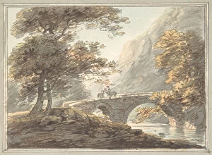
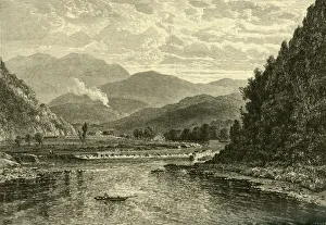
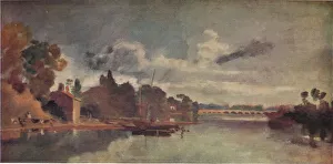
Denham Bridge upon the Tavy, 1780-1830. Creator: William PayneDenham Bridge upon the Tavy, 1780-1830
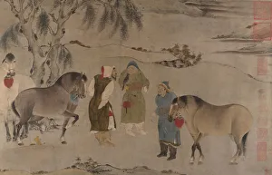
Six Horses, 13th-14th century. Creator: UnknownSix Horses, 13th-14th century. Figuresin Khitan costumes
Thanka with Buddha, 19th century. Creator: UnknownThanka with Buddha, 19th century
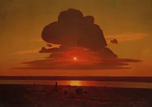
Red Sunset on the Dnieper, 1905-8. Creator: Arkhip Ivanovich KuindzhiRed Sunset on the Dnieper, 1905-8
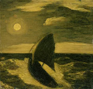
The Toilers of the Sea, ca. 1880-85. Creator: Albert Pinkham RyderThe Toilers of the Sea, ca. 1880-85
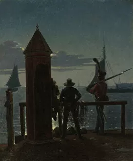
View from the Citadel Ramparts in Copenhagen by Moonlight, 1839. Creator: Martinus RorbyeView from the Citadel Ramparts in Copenhagen by Moonlight, 1839
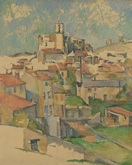
Gardanne, 1885-86. Creator: Paul CezanneGardanne, 1885-86
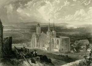
Oppenheim, c1872. Creator: E I RobertsOppenheim, c1872. View of the Katharinenkirche, a gothic church in the town of Oppenheim in Germany. The roof of the apse is missing
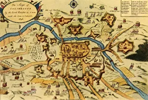
The Siege of Colchester by the Parliament Forces... 1648, (1944). Creator: W KeymerThe Siege of Colchester by the Parliament Forces Under the Command of General Fairfax, 1648, (1944). Map of the town of Colchester in Essex which was attacked by Parliamentary commander Lord-General
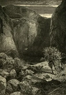
Glen Canon, 1874. Creator: W. J. LintonGlen Canon, 1874. View of Glen Canyon, part of an immense system of canyons carved out by the Colorado River and its tributaries in Utah and Arizona, USA
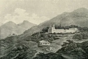
A view of the Royal Villa of the Generalife at Granada, 19th century, (1907). Creator: UnknownA view of the Royal Villa of the Generalife at Granada, 19th century, (1907). The Generalife, built in the 13th century, is adjacent the fortress and palace of the Alhambra, Granada, Spain
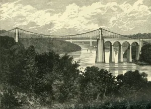
The Menai Suspension Bridge, 1898. Creator: UnknownThe Menai Suspension Bridge, 1898. Grade I listed Menai Suspension Bridge designed by Thomas Telford and completed in 1826 carrying traffic from Anglesey across the Menai Strait
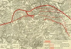
positions in the Battle of Verdun, northern France, First World War, 1916, (c1920)French and German positions in the Battle of Verdun, northern France, First World War, 1916, (c1920). Solid red line indicates French
Nanticoke Dam, 1874. Creator: John FilmerNanticoke Dam, 1874. The Susquehanna River at Nanticoke, Pennsylvania, USA....Nanticoke, where the river expands considerably, becoming very shallow
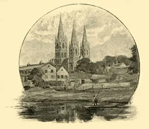
St. Finbars Cathedral, 1898. Creator: UnknownSt. Finbars Cathedral, 1898. Saint Fin Barres Cathedrall, a Gothic Revival three-spire cathedral in the city of Cork, Ireland completed in 1879 on the south side of the River Lee
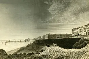
East View of Brighton from Kemp Town, 1835. Creator: Dean WolstenholmeEast View of Brighton from Kemp Town, 1835. Antique engraving by Dean Wolstenholme Junior after Thomas Henwood. From " The History, Antiquities, and Topography of the County of Sussex
Danejohn Hill, Canterbury, Kent, 1829. Creator: James Baylis AllenDanejohn Hill, Canterbury, Kent, 1829. The Dane John Mound, a former Roman cemetery, was converted into a motte-and-bailey castle in the 11th century
The New Castelkerke, c1850s. Creator: UnknownThe New Castelkerke, c1850s. View of Castlekirk on Lough Corrib, a lake in Galway in the west of Ireland. Landscape view, possibly from an illustrated account by the Rev Alexander RC Dallas on his
Loch-tay, from Killin, 1802. Creator: UnknownLoch-tay, from Killin, 1802. [Messrs Longman & Rees, London, 1802]
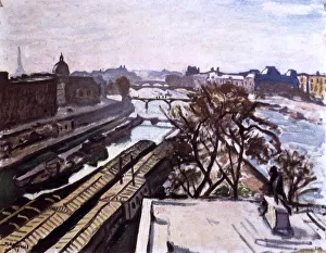
View of the Seine and the Monument to Henry IV, c1906. Artist: Albert MarquetView of the Seine and the Monument to Henry IV, c1906. Albert Marquet was born in Bordeaux, France. He was both very young
Missouri River, below Great Falls, Montana, c1897. Creator: UnknownMissouri River, below Great Falls, Montana, c1897. Named by William Clark of the Lewis and Clark Expedition in 1805, most water is now diverted to a hydroelectric plant at the Ryan Dam
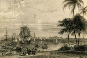
Calcutta, from Garden house reach, 1835. Creator: William DaniellCalcutta, from Garden house reach, 1835. From " The Oriental Annual, or Scenes in India", by William Daniell, R.A. [Bull and Churton, London, 1835]
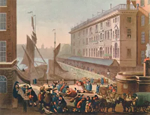
Billingsgate Fish Market, 1808, (1944). Creators: Thomas Rowlandson, Augustus Charles PuginBillingsgate Fish Market, 1808, (1944). View of the old open-air fish market on the banks of the River Thames in the City of London. Fresh fish was landed and sold directly on the dockside
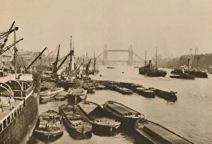
Shipping in the Pool of London: A Vista from London Bridge to Tower Bridge, c1935. Barges on the River Thames. From " Wonderful London, Volume 1", edited by Arthur St John Adcock
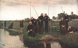
Thursday, 1880, (c1902). Creator: UnknownThursday, 1880, (c1902). After a painting, also known as Tomorrow will be Friday, in the Tate Gallery, London. A group of Franciscans fishing, as they were forbidden to eat meat on Fridays
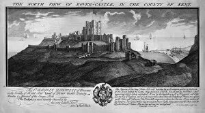
The North View of Dover-Castle, in the County of Kent. c1735. Artists: Samuel BuckThe North View of Dover-Castle, in the County of Kent. c1735. An earlier earthen castle was rebuilt in stone in the 1180s by King Henry II
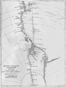
Map - British Antarctic Expedition 1910-13. Track Chart of Main Southern Journey, 1913. The final expedition of British Antarctic explorer Captain Robert Falcon Scott (1868-1912)
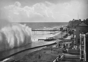
A Big Sea at Bognor, c1896. Artist: Poulton & CoA Big Sea at Bognor, c1896. From Pictorial England and Wales. [Cassell and Company, Limited, London, Paris & Melbourne, c1896]
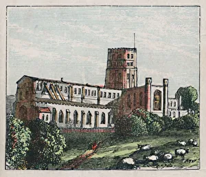
St Albans, c1910. The Abbey. Founded in honour of Englands Proto-martyr, A.D. 796. Straw plaiting. Boots. Shoes. Population, 18, 130. Card from The Counties of England - A Geographical Game
Grange-Over-Sands, c1896. Artist: Gilbert WilsonGrange-Over-Sands, c1896. From Pictorial England and Wales. [Cassell and Company, Limited, London, Paris & Melbourne, c1896]
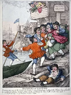
Miseries of London, 1812. A woman walking down Wapping Old Stairs being assailed by a group of watermen plying for trade. Two figures watch from a balcony
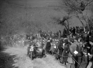
748 cc BSA and sidecar of HJ Finden at the MCC Lands End Trial, Beggars Roost, Devon, 1936BSA & sidecar 748 cc. Event Entry No: 140 Rider: Finden, H.J. Award: Premier. Place: Beggars Roost North Devon. M.C.C. Lands End Trial. Date: 10/11.4.36
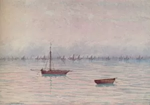
A Fishing Fleet, 1910. Artist: William Biscombe GardnerA Fishing Fleet, 1910. From The British Isles in Pictures, by H. Clive Barnard, M.A. D.Lit. [A. & C. Black, Limited, London, 1910]
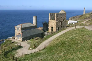
Levant Mine, Cornwall. The Levant Mine operated from the late 18th century until its closure in 1930, mining tin and copper from beneath the sea bed
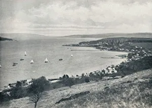
Sandbank - From the East, Showing Sandbank and Kilmun, 1895. From Round the Coast. [George Newnes Limited, London, 1895]
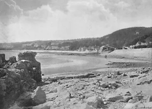
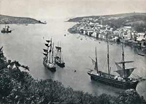
Fowey - Entrance to the Harbour, 1895. From Round the Coast. [George Newnes Limited, London, 1895]
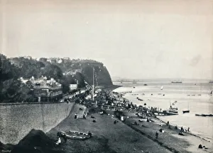
Penarth - The Esplanade and Penarth Head, 1895. From Round the Coast. [George Newnes Limited, London, 1895]
Leisure Hours, 1905. Artist: Mortimer Luddington MenpesLeisure Hours, 1905. From India, by Mortimer Menpes. Text by Flora A. Steel. [Adam & Charles Black, London, 1905]
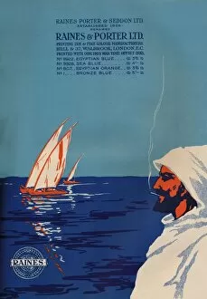
Raines & Porter Ltd. Advert, 1919. Artist: Raines & PorterRaines & Porter Ltd. Advert, 1919. From The British Printer Vol. XXXI. [Raithby, Lawrence & Co. Ltd, London and Leicester, 1919]
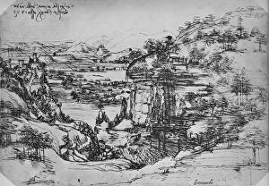
Landscape, c1480 (1945). Artist: Leonardo da VinciLandscape, c1480 (1945). From The Drawings of Leonardo da Vinci. [Reynal & Hitchcock, New York, 1945]
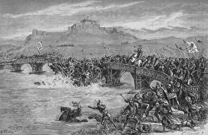
The Battle of Stirling Bridge, 11 September 1297, (c1880). The Battle of Stirling Bridge was a battle of the First War of Scottish Independence
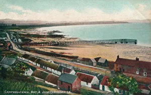
Campbelltown Bay & Jetty Ardersier, c1930. Ardersier is a small former fishing village in the Scottish Highlands. [H. W. F. & Co. c1930]
Warlock Knowe, 1872. Artist: William Leighton LeitchWarlock Knowe, 1872. From A Catalogue of the Pictures and Drawings in the collection of Frederick John Nettleford Volume III. - I to S, by C. Reginald Grundy and F. Gordon Roe. [Bemrose and Sons Ltd
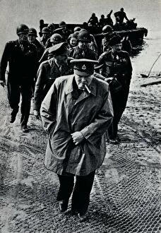
Churchill, Brooke, and Montgomery on the German-held east bank of the Rhine, 25th March, 1945. After Operation Plunder, Churchill, Montgomery, and a party of U.S
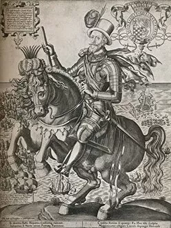
Lord Howard of Effingham, c1600. Artist: Thomas CocksonLord Howard of Effingham, c1600. Charles Howard, 1st Earl of Nottingham (1536-1624), Earl of Nottingham. The Armada and the English fleet in Cadizin is in the background
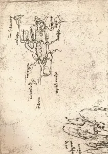
Sketch map of Armenia, c1472-c1519 (1883). Artist: Leonardo da VinciSketch map of Armenia, c1472-c1519 (1883). From the Codex Atlanticus. From The Literary Works of Leonardo Da Vinci, Vol. II by Jean Paul Richter, PH. DR
Fredrigo Di Montefeltro, Duke of Urbino, c1465. (1914). Artist: Piero della FrancescaFredrigo Di Montefeltro, Duke of Urbino, c1465. This is a detail of a larger diptych which depicts the Duke Federigo da Montefeltro (1422-1482) and his wife Battista Sforza (1447-1472)
The Thames near Walton Bridges, 1805, (1938). Artist: JMW TurnerThe Thames near Walton Bridges, 1805. After an original oil paint on mahogany veneer by Joseph Mallord William Turner (1775-1851). Original housed in the Tate, London