mail_outline sales@mediastorehouse.com
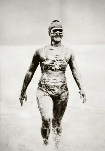
Gertrude Ederle, American swimmer, 1926. On 6 August 1926 Ederle (1905-2003) became the first woman to swim across the English Channel, which she achieved in a time of 14 hours and 30 minutes
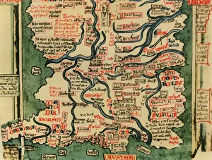
Matthew Pariss Map of Great Britain showing rivers & towns in the south of England & part of Wales, c. 1250 (1944)Many place-names are still recognisable today. The word Auster, written over the English Channel at the bottom, refers to wind bringing heavy cloud cover and fog
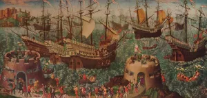
The Embarkation of Henry VIII at Dover c1540The Embarkation at Dover c1540. Henry VIII and his fleet setting sail from Dover to Calais on 31 May 1520 on the way to meet Francis I at The Field of Cloth of Gold
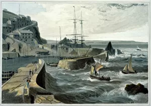
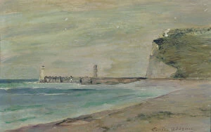
Mevagissey, Cornwall, 1825. Artist: William DaniellMevagissey, Cornwall, 1825. From A Voyage Around Great Britain Undertaken between the Years 1814 and 1825 by William Daniell
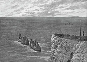
The Needles, Isle of Wight, c1896. Artist: Poulton & CoThe Needles, Isle of Wight, c1896. From Pictorial England and Wales. [Cassell and Company, Limited, London, Paris & Melbourne, c1896]
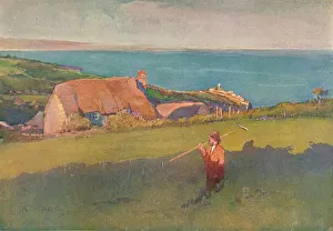
Across Mounts Bay, c1880. Artist: Elizabeth Adela ForbesAcross Mounts Bay, c1880. Painting held in the Victoria and Albert Museum, London. From The Studio Volume 47. [London Offices of the Studio, London, 1909]
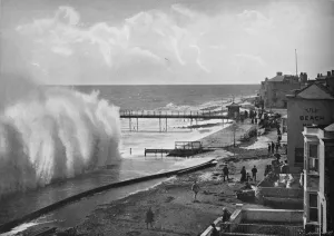
A Big Sea at Bognor, c1896. Artist: Poulton & CoA Big Sea at Bognor, c1896. From Pictorial England and Wales. [Cassell and Company, Limited, London, Paris & Melbourne, c1896]
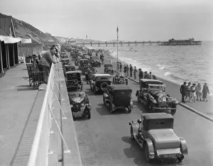
Cars on Undercliff Drive, Bournemouth, Bournemouth Rally, 1928. Artist: Bill BrunellUndercliff Drive, Bournemouth. Bournemouth Rally. Date: 5-8.7.28
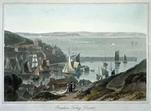
Brixham, Torbay, Devon, 1825. Artist: William DaniellBrixham, Torbay, Devon, 1825. From A Voyage Around Great Britain Undertaken between the Years 1814 and 1825 by William Daniell
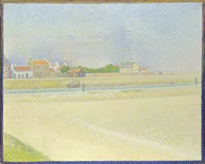
The Channel of Gravelines, Grand Fort-Philippe, 1890. Artist: Seurat, George Pierre (1859-1891)The Channel of Gravelines, Grand Fort-Philippe, 1890. Found in the collection of the National Gallery, London
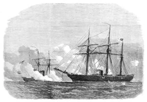
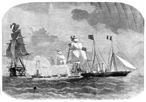
The fight between the Alabama and the Kearsarge, 1864. Creator: UnknownThe fight between the Alabama and the Kearsarge, 1864. American Civil War - sea battle off Cherbourg on 19th June, from a sketch by Robert Lancaster, the owner of the yacht Deerhound
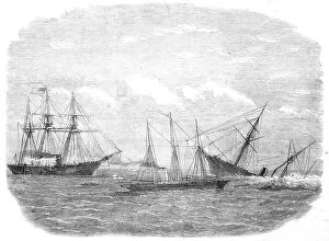
The Deerhound rescuing a portion of the crew of The Alabama, 1864. Creator: UnknownThe Deerhound rescuing a portion of the crew of The Alabama, 1864. American Civil War - view of the sea battle off Cherbourg on 19th June, '...from the plan and information supplied by Mr
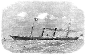
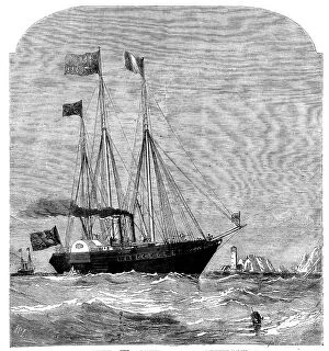
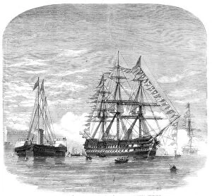
The London, Chatham, and Dover Railway Company's new steam-boat The Prince Imperial, 1864. 'Our Engraving represents the new paddle-wheel steam-boat Prince Imperial
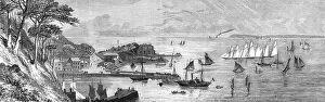
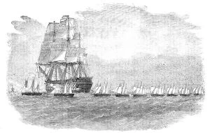
Torbay Regatta: the schooner-yachts starting from Torquay, 1864. Creator: UnknownTorbay Regatta: the schooner-yachts starting from Torquay, 1864. Engraving from a sketch by Mr. G. Whitaker. 'The course was three times round the bay
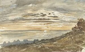
Sunset at Trouville, 1813-1869. Creator: Paul HuetSunset at Trouville, 1813-1869
Her Majesty leaving Cherbourg, 1858. Creator: SmythHer Majesty leaving Cherbourg, 1858. Queen Victoria returns to England on the Royal Yacht....a farewell visit was paid by the Emperor and Empress;
The Cherbourg Fetes - Arrival of Her Majesty at Cherbourg, 1858. Creator: UnknownThe Cherbourg Fetes - Arrival of Her Majesty at Cherbourg, 1858. When the Queen [Victoria] and her suite arrived at Cherbourg there were great demonstrations on shore
The Cherbourg Fetes - the Royal Yacht passing the Needles, 1858. Creator: Richard Principal LeitchThe Cherbourg Fetes - the Royal Yacht passing the Needles, 1858. Queen Victoria travels to France. On Thursday week the Victoria and Albert, on her way to Cherbourg
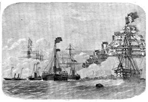
Terrible; Valorous; Royal Albert, 131, Flag of Vice-Admiral Lyons... 1858. Creator: UnknownHer Majesty en route for Cherbourg, 1858. Queen Victoria visits the French emperor with her escort squadron. Terrible; Valorous; Royal Albert, 131
Cherbourg, 1858. Creator: UnknownCherbourg, 1858. Between the French port and the English coast roll sixty or seventy good miles of ocean; and, when you have inspected Cherbourg
Her Majesty en route for Cherbourg, 1858. Creator: UnknownHer Majesty en route for Cherbourg, 1858. Queen Victoria travels...to visit the Emperor and Empress of the French at Cherbourg
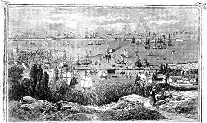
Cherbourg Roads: Mooring-ground for Men-of-War, 1858. Creator: UnknownCherbourg Roads: Mooring-ground for Men-of-War, 1858. The inner dock of Cherbourg is 1260 feet long and 600 broad. It is capable of receiving an entire fleet
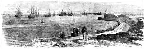
Cherbourg from the Sea, 1858. Creator: UnknownCherbourg from the Sea, 1858. Port on the north coast of France. Cherbourg is situated in the peninsula of Cotentin, the ancient Lower Normandy'. From "Illustrated London News", 1858
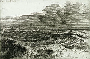
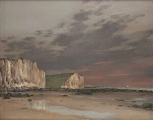
Mount's Bay, 1868. Creator: Francis Seymour HadenMount's Bay, 1868
Embarkation of the Prince of Wales in H.M.S. "Hero" at Plymouth for Canada, 1860. Creator: UnknownEmbarkation of the Prince of Wales in H.M.S. "Hero" at Plymouth for Canada, 1860. The future King Edward VII goes on a royal visit to North America - sailors manning the yards
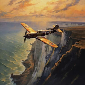
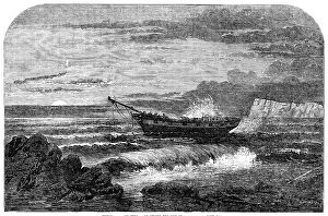
AI IMAGE - Spitfire aircraft flying over the White Cliffs of Dover, 1940s, (2023). Creator: Heritage ImagesAI IMAGE - Spitfire aircraft flying over the White Cliffs of Dover, 1940s, (2023). British single-seat fighter aircraft used by the Royal Air Force and other Allied countries before, during
The Cherbourg Fetes - the "Pera" with Members of the House of Commons, leaving Southampton, 1858. British politicians travel to France
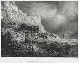
Near Dieppe, 1833. Creators: Thomas McLean, Eugene IsabeyNear Dieppe, 1833. From Six Marines
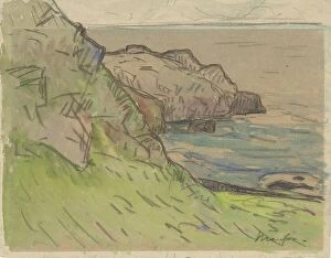
Côte rocheuse en Bretagne. Rocky coast in Brittany, 1871-1918. Creator: Maxime Emile Louis MaufraCote rocheuse en Bretagne. Rocky coast in Brittany, 1871-1918
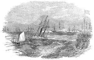
Plymouth Regatta - start of yachts in the first race - froma sketch by J. Offord, Plymouth, 1860. Creator: SmythPlymouth Regatta - start of yachts in the first race - from a sketch by J. Offord, Plymouth, 1860. The annual Royal Western Yacht Club of England
Rocky coast at Boulogne sur Mer, 1829. Creator: Petrus Johannes SchotelRocky coast at Boulogne sur Mer, 1829
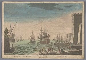
View of the harbour in Calais, 1745-1775. Creator: AnonView of the harbour in Calais, 1745-1775. Ships and boats lie on the water. On the right a fortresss, and groups of figures on the waterfront
Wreck of "The George Lord", off the Isle of Wight, 1856. Creator: Edmund EvansWreck of "The George Lord", off the Isle of Wight, 1856. Ship bound for London, ...laden with a valuable cargo of fruit from Zante
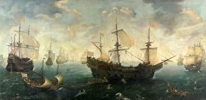
The Spanish Armada off the English Coast in 1588, c.1620-c.1625. Creator: Cornelis Claesz van WieringenThe Spanish Armada off the English Coast in 1588, c.1620-c.1625
The Running Down of Lord Alfred Paget's Yacht "Alma" off Dover, 1856. Creator: UnknownThe Running Down of Lord Alfred Paget's Yacht "Alma" off Dover, 1856. Collision at sea. Lord Alfred Paget describes the loss of his yacht
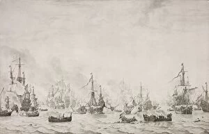
The Battle of the Downs, 1659. Creator: Willem van de Velde IThe Battle of the Downs, 1659. Other Title(s): The Battle of the Downs against the Spanish Armada, 21 October 1639
The Gun-Boat Flotilla off Portland - sketched by Lieutenant Montagu O'Reilly, 1856. Creator: UnknownThe Gun-Boat Flotilla off Portland - sketched by Lieutenant Montagu O'Reilly, 1856....the Squadron...from a Sketch...by Lieutenant Montagu O'Reilly, now in command of H.M
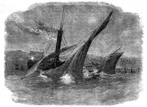
Collision in the English Channel, between the Steamer "Mangerton" and "The Josephine Willis", 1856. The mate [of the Josephine Willis]...shouted to the steamer; but no notice was
Mesnilval, c1894. Creator: Jean-Charles CazinMesnilval, c1894
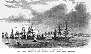
French Fleet for the Baltic at Deal, 1854. Creator: UnknownFrench Fleet for the Baltic at Deal, 1854. From "Cassells Illustrated Family Paper; London Weekly 31/12/1853 - 30/12/1854"
Beach landscape, Fécamp. Creator: Louise AbbemaBeach landscape, Fecamp
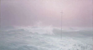
Cross in the mist, Brittany, 1905. Creator: Henry BrokmanCross in the mist, Brittany, 1905
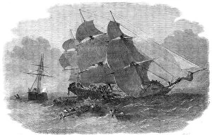
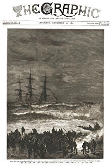
'The Graphic, Front Cover Saturday, November 21, 1891, 1891. Creator: Unknown'The Graphic, Front Cover Saturday, November 21, 1891, 1891. The Wreck of the Three-Masted Ship "Benvenue" at Sandgate. From "The Graphic
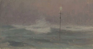
Cross and wave, Brittany, c.1905. Creator: Henry BrokmanCross and wave, Brittany, c.1905
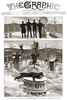
'The Graphic, Front Cover Saturday, November 28, 1891, 1891. Creator: Unknown'The Graphic, Front Cover Saturday, November 28, 1891, 1891. The Very Last Wave - an Incident in the Cruise of the Channel Squadron. From "The Graphic
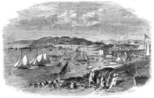
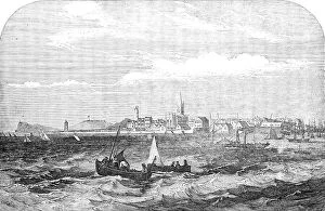
Harwich, 1854. Creator: M. JacksonHarwich, 1854. Port in Essex. This important line of railway, which will considerably shorten the distance between the metropolis and the Hague and the northern fiart of Europe
The Emperor leaving Calais Harbour, to visit the English Squadron, 1854. Creator: UnknownThe Emperor leaving Calais Harbour, to visit the English Squadron, 1854. French emperor and president Napoleon Bonaparte III inspects Royal Navy ships off the coast of France before they leave for
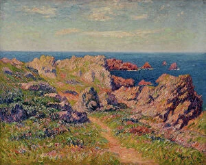
Good weather in Pern (Ile d'Ouessant), 1901. Creator: Henri MoretGood weather in Pern (Ile d'Ouessant), 1901