mail_outline sales@mediastorehouse.com
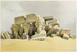
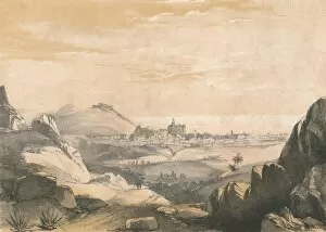
Ruins of the Temple of Kom Ombo, Egypt, c1845. Artist: David RobertsRuins of the Temple of Kom Ombo, Egypt, c1845. From Egypt and Nubia, Vol 1, by David Roberts
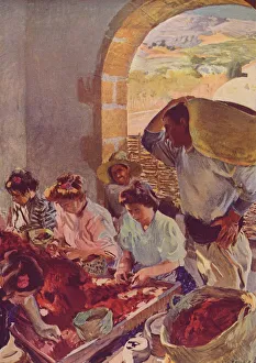
The Preparation of Dry Grapes, 1890, (c1932). Artist: Joaquin Sorolla y BastidaThe Preparation of Dry Grapes, 1890, (c1932). From Modern Art by Charles Marriott & Tis & Tis. [Colour Ltd. London, 1909]
Nakumura Shukaku in Ichiwa Ichigon, 1879. Creator: Tsukioka YoshitoshiNakumura Shukaku in Ichiwa Ichigon, 1879. Series: News from the Kabuki Theater
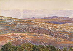
Mountainous Landscape in Egypt, 1880-1922. Creator: Marius BauerMountainous Landscape in Egypt, 1880-1922
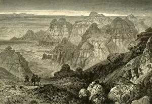
The Nebraska and Kansas Territory: Ancient Bluff Ruins, Nebraska, 1856. Creator: UnknownThe Nebraska and Kansas Territory: Ancient Bluff Ruins near Fort Larumie [sic], Nebraska, 1856. View of...extensive unoccupied territory of the United States...[which] hitherto has been the home of
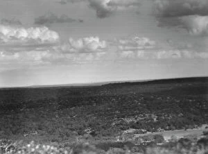
Travel views of the American Southwest, between 1899 and 1928. Creator: Arnold GentheTravel views of the American Southwest, between 1899 and 1928
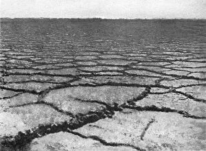
'Terrain argileux crevasse la chaleur; Afrique du nord, 1914. Creator: Jules Gervais-Courtellemont'Terrain argileux crevasse la chaleur; Afrique du nord, 1914. From "Grande Geographie Bong Illustree", 1914
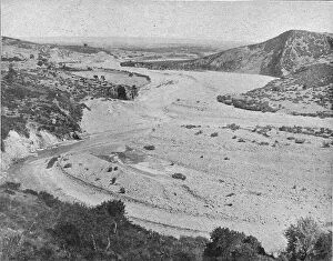
'Un oued; Afrique du nord, 1914. Creator: Unknown'Un oued; Afrique du nord, 1914. From "Grande Geographie Bong Illustree", 1914
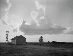
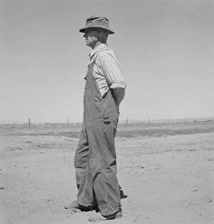
West Texas "family farm", on edge of the Dust Bowl, 1937. Creator: Dorothea LangeWest Texas "family farm." On edge of the Dust Bowl
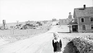
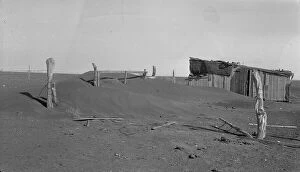
The town of Mills, New Mexico, 1935. Creator: Dorothea LangeThe town of Mills, New Mexico. The grain elevator in background at right has been long ago abandoned. The bank is closed
Dust Bowl farm, Coldwater District, near Dalhart, Texas, 1938. Creator: Dorothea LangeDust Bowl farm. Coldwater District, near Dalhart, Texas. This farm is occupied. Others in this area have been abandoned
Southern New Mexico toward El Paso, Texas, 1938. Creator: Dorothea LangeSouthern New Mexico toward El Paso, Texas
Abandoned farm on the high plains, Texas County, Oklahoma, 1938. Creator: Dorothea LangeAbandoned farm on the high plains, Texas County, Oklahoma. "The record of the Great Plains is to a great extent a record of settlement and abandonment." J. Russell Smith
Barn and shed of farm in the Texas Panhandle, near Boise City, Texas, 1938. Creator: Dorothea LangeBarn and shed of farm in the Texas Panhandle. Near Boise City, Texas
Eroding field and fence, Greene County, Georgia, 1937. Creator: Dorothea LangeEroding field and fence. Greene County, Georgia
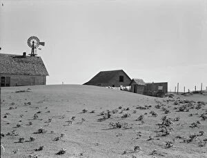
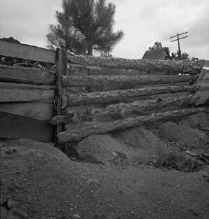
Fence corner and outbuilding being buried by dust, Mills, New Mexico, 1935. Creator: Dorothea LangeFence corner and outbuilding being buried by dust. Misuse of lands is the chief cause of results such as this. Mills, New Mexico
California desert mountains, San Luis Obispo County, 1937. Creator: Dorothea LangeCalifornia desert mountains. San Luis Obispo County
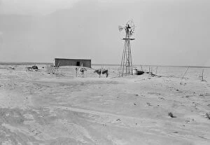
Central Utah dry land adjustment project, forty miles from Tooele, Utah, 1936. Creator: Dorothea LangeCentral Utah dry land adjustment project, forty miles from Tooele, Utah
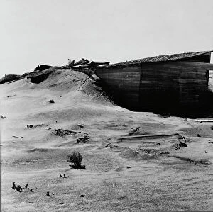
Abandoned farm, Coldwater District, north of Dalhart, Texas, 1938. Creator: Dorothea LangeAbandoned farm. Coldwater District, north of Dalhart, Texas
Possibly: Chris Ament, German-Russian dry land wheat farmer, who survived... Columbia Basin, 1939[Untitled, possibly related to: Chris Ament, German-Russian dry land wheat farmer, who survived in the Columbia Basin. Washington, Grant County, three miles south of Quincy.]
Chris Ament, German-Russian dry land wheat farmer, who survived... Columbia Basin, 1939. Creator: Dorothea LangeChris Ament, German-Russian dry land wheat farmer, who survived in the Columbia Basin. Washington, Grant County, three miles south of Quincy
Chris Ament, on dry land wheat farm of Columbia Basin where... south of Quincy, Washington, 1939Chris Ament, on dry land wheat farm of Columbia Basin where he has farmed for thirty three years. " I won t live to get the benefits of the water
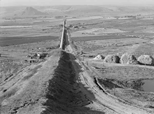
The longest siphon in the world crosses the Malheur Valley, Malheur County, Oregon, 1939. Creator: Dorothea LangeThe longest siphon in the world crosses the Malheur Valley. It carries water to the bench land beyond a division of the project called Dead Ox Flat. Malheur County, Oregon-67
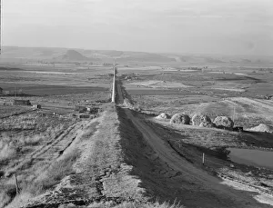
Siphon - the worlds longest - which carries water 5 miles to Dead Ox Flat, Oregon, 1939. Creator: Dorothea Lange[Untitled, possibly related to: Siphon--the worlds longest--which carries water five miles to Dead Ox Flat. It is eight feet in diameter. Malheur County, Oregon]
View of small valley, dry farming, Gem County, Idaho, 1939. Creator: Dorothea LangeView of small valley, dry farming. Gem County, Idaho
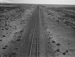
Western Pacific line runs through unclaimed desert of northern Oregon, 1939. Creator: Dorothea LangeWestern Pacific line runs through unclaimed desert of northern Oregon. Ten miles from railroad station at Irrigon. Morrow County, Oregon
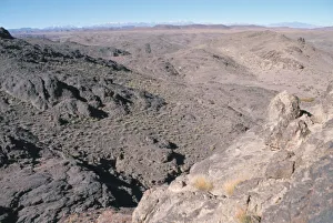
Alvord Desert. Creator: Joshua JohnstonAlvord Desert
Attendant que le linge seche! Cologne, 1858. Creator: James Abbott McNeill WhistlerAttendant que le linge seche! Cologne, 1858
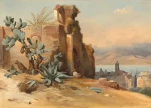
Ancient Ruins near Messina, Sicily, 1842. Creator: Charles RemondAncient Ruins near Messina, Sicily, 1842
The Dead Sea from Siloam, 1861. Creator: William Holman HuntThe Dead Sea from Siloam, 1861
Terres Mauvaises, Utah, 1874. Creator: John FilmerTerres Mauvaises, Utah, 1874. Badlands - dry terrain where softer sedimentary rocks and clay-rich soils have been eroded by wind and water - in Utah, USA
Malaga, from the Ermitas, c1850. Creator: Dickinson BrothersMalaga, from the Ermitas, c1850. The town of Malaga in Andalusia, southern Spain
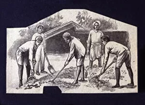
Native spreading cocoa beans to dry at sun, drawing, 1914
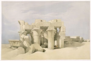
Temple of Sobek and Horuss at Kom Ombo, Egypt, 19th century. Artist: David RobertsTemple of Sobek and Horus at Kom Ombo, Egypt, 19th century. From Egypt and Nubia, Vol 2, by David Roberts
Trans Atlas, Morocco
The Empty Quarter, Oman
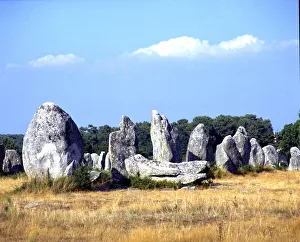
Kermario Alignments, Carnac, France
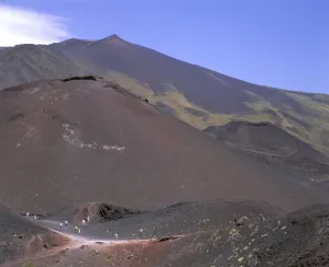
View of the volcanic scenery of Mount Etna, Sicily, Italy
In a Barren and Dry Land, Where No Water Is, c1880, (1904). Artist: Robert George Talbot KellyIn a Barren and Dry Land, Where No Water Is, c1880, (1904). From Egypt, by R. Talbot Kelly. [Adam & Charles Black, London, 1904]
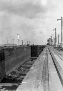
Lock on the Panama Canal, 1931. The idea of building a canal between the Atlantic and Pacific was first planned by the French civil engineer and builder of the Suez Canal, Ferdinand de Lesseps
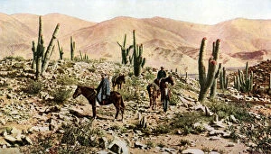
Atacama Desert, Northern Chile, South America, c1923. The Atacama is the driest desert on Earth. A print from Countries of the World, Volume VI, edited by JA Hammerton, The Fleetway House, London
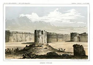
Grand Coulee, Washington, USA, 1856. Artist: Gustav SohonGrand Coulee, Wahington, USA, 1856. A view of the Grand Coulee that extends from the head of present-day Grand Coulee Dam over fifty miles southwest to Ephrata, Washington
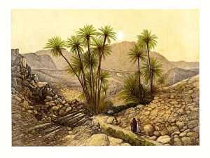
The Desert of Sinai, Egypt, c1870. Artist: W DickensThe Desert of Sinai, Egypt, c1870. Illustration from Sinai and Jerusalem; or Scenes from the Bible Lands by the Rev FW Holland, (London, c1870)
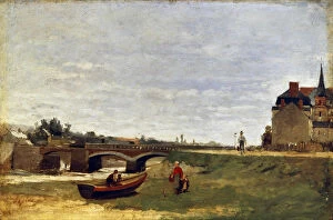
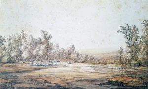
Landscape with a Bridge, early 1870s. Artist: Stanislas LepineLandscape with a Bridge, early 1870s. Found in the collection of the State Hermitage, St Petersburg
Landscape, 1620-1691. Artist: Aelbert CuypLandscape, 1620-1691
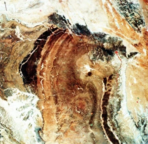
Satellite photograph of Great Namaland, Namibia, 1972. Photographed by Landsat 1. The satellites multispectral scanner reveals lithologic and structural features with clarity
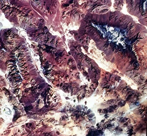
Death Valley, California, USA, 1982-1993. First full scene from the Thematic Mapper on Landsat 4. The vegetation-sparse terrain is dominated by landforms and other geological features
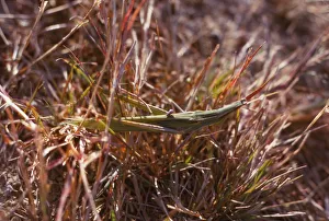
Grasshopper and small bug in grass, Kortobacy Puszta, Hungary, 20th century Artist: CM DixonGrasshopper and small bug in grass, Puszta, Hungary, 20th century. The Puszta is a grassland biome on the Great Hungarian Plain