mail_outline sales@mediastorehouse.com
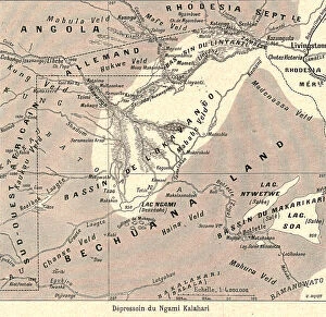
'Depressoin du Ngami Kalahari; Afrique Australe, 1914. Creator: Unknown'Depressoin du Ngami Kalahari; Afrique Australe, 1914. From "Grande Geographie Bong Illustree", 1914
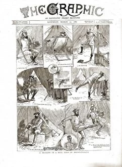
The Graphic, Front Cover March 27th.1886, 1886. Creator: UnknownThe Graphic, Front Cover March 27th. 1886, 1886. A tragedy in a bell tent in Bechuanaland. From "The Graphic. An Illustrated Weekly Newspaper Volume 33. January to June, 1886"
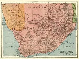
Map of South Africa, c1914, (c1920). Creator: John Bartholomew & SonMap of South Africa, c1914, (c1920). Map of the southern tip of Africa at the start of the First World War, showing German South-West Africa (later Namibia)
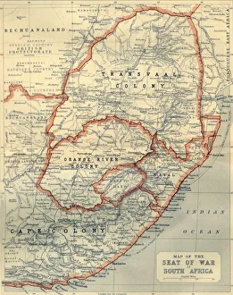
Map of the Seat of War in South Africa, 1901. Creator: John BartholomewMap of the Seat of War in South Africa, 1901. Map showing Bechuanaland, Transvaal Colony, Orange River Colony, Natal, Basutoland and Cape Colony, the theatre of war during the Boer Wars (1880-1902)
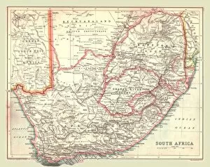
Map of South Africa, 1902. Creator: UnknownMap of South Africa, 1902. Showing the Cape Colony, Transvaal, Orange River Colony, and other colonial possessions including the British Protectorate of Bechuanaland, German South West Africa