mail_outline sales@mediastorehouse.com
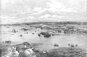
Cronstadt, from the Narrow Part of the Channel nearest St. Petersburg, drawn by E.T. Dolby, 1854. Creator: UnknownCronstadt, from the Narrow Part of the Channel nearest St. Petersburg, drawn by E.T. Dolby, 1854. Defences in the Russian port city during the Crimean War
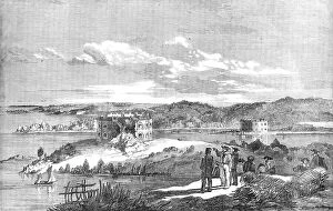
Fort Nottich, Bomarsund - Breach made by an English Three-gun Battery - from a sketch by... 1854. Creator: UnknownFort Nottich, Bomarsund - Breach made by an English Three-gun Battery - from a sketch by O.W. Brierly, 1854. Crimean War: view of the Russian-held Notvik Tower and Prasto Tower in Finland
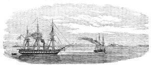
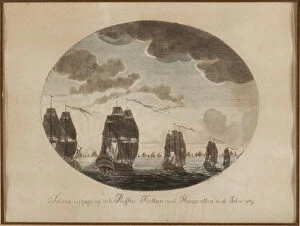
Steam-ships reconnoitring at Sveaborg, in the Gulf of Finland, 1854. Creator: UnknownSteam-ships reconnoitring at Sveaborg, in the Gulf of Finland, 1854. Crimean War: Royal Navy ships off Russian-held Sveaborg [modern Suomenlinna]
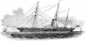
The Emperor of Russia's Steam-Yacht "Peterhoff", 1850. Creator: UnknownThe Emperor of Russia's Steam-Yacht "Peterhoff", 1850. We regret to announce that the splendid steam-yacht...which was built in this country a few months since
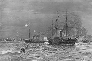
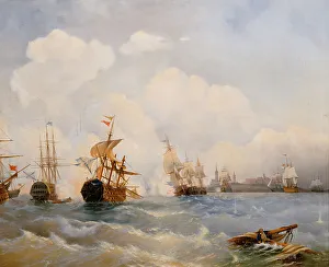
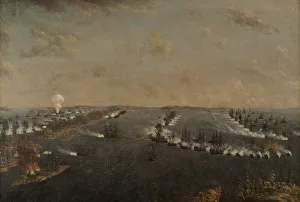
The Crimean War, 1854-56, The Bombardment of Sveaborg by the Baltic Fleet, (1901). Episode of the Crimean War (1853-1856)
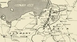
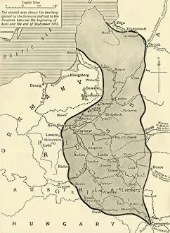
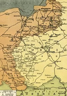
Map illustrating the Russian Invasion of East Prussia, 1915. Creator: UnknownMap illustrating the Russian Invasion of East Prussia, 1915. From August to September 1914, the Russian Empire invaded Germany on the Eastern Front
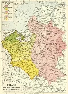
Poland and the Partitions of 1772, 1793 & 1795, (c1920). Creator: John Bartholomew & SonPoland and the Partitions of 1772, 1793 & 1795, (c1920). Map showing how territory in Europe was divided between the empires of Russia, Prussia and Austria in the 18th century
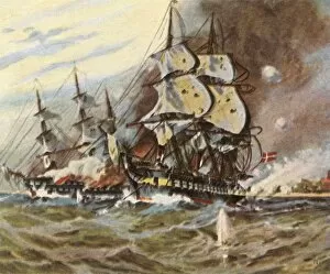
HMS Wachtmeister fighting against the Russian squadron on Juny 4, 1719, 1895. Private Collection
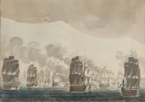
The naval Battle of Reval on 13 May 1790, 1860s. Artist: Bogolyubov, Alexei Petrovich (1824-1896)The naval Battle of Reval on 13 May 1790, 1860s. Found in the collection of the State Central Navy Museum, St. Petersburg
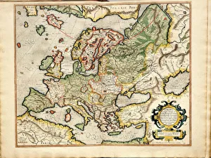
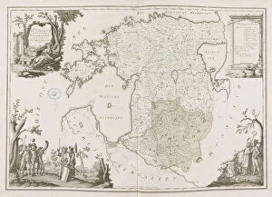
Atlas sive Cosmographicae Meditationes de Fabrica Mundi et Fabricati Fugura (Europe: Livonia, Russia Artist: Mercator)Atlas sive Cosmographicae Meditationes de Fabrica Mundi et Fabricati Fugura (Europe: Livonia, Russia, Lithuania). Private Collection
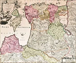
The Baltic Sea (From: Baltikum Ducatuum Livoniae et Curlandiae cum vicinis Insulis Nova Exhibitio Geographica), ca 1720. From a private collection
Fehmarn Girls, 1913. Creator: Ernst KirchnerFehmarn Girls, 1913
View of Sommerspiret, the Cliffs of Mon, 1846. Creator: Georg Emil LibertView of Sommerspiret, the Cliffs of Mon, 1846
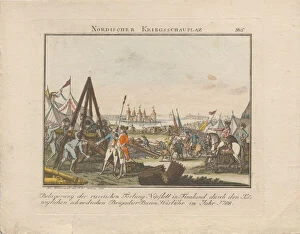
Siege of the Russian fortress Nyslott in Finland, 1788. Creator: WeinrauchSiege of the Russian fortress Nyslott in Finland, 1788. Private Collection
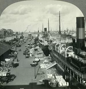
The Harbor of Copenhagen, Metropolis of Denmark, c1930s. Creator: UnknownThe Harbor of Copenhagen, Metropolis of Denmark, c1930s. Danish port on the Baltic Sea. From " Tour of the World". [Keystone View Company, Meadville, Pa. New York, Chicago, London]
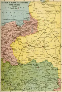
German & Austrian Frontiers with Russia, First World War, (c1920). Creator: UnknownGerman & Austrian Frontiers with Russia, First World War, (c1920). Map of eastern Europe and the Baltic coast. From "The Great World War: A History", Volume VII, edited by Frank A Mumby
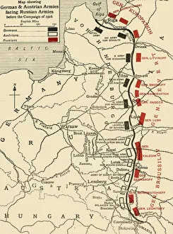
Map showing German & Austrian Armies facing Russian Armies before the Campaign of 1916, (c1920). Creator: UnknownMap showing German & Austrian Armies facing Russian Armies before the Campaign of 1916, (c1920). Positions of the adversarial armies in eastern Europe during the First World War
The Eastern Area of the Great War, 1915. Creator: UnknownThe Eastern Area of the Great War, 1915. The Eastern Front was a frontier between the Russian Empire and Romania on one side and the Austro-Hungarian Empire, Bulgaria
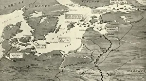
Map indicating the Position of the Allied Naval Victory in the Baltic, 1916. Creator: UnknownMap indicating the Position of the Allied Naval Victory in the Baltic, 1916. A British submarine flotilla operated in the Baltic Sea for three years during the First World War, on 19 August 1915
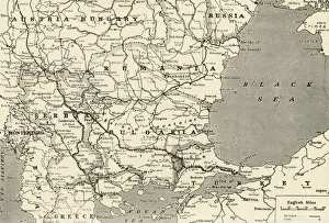
Map Showing the Relation of Serbia to Neighbouring States, 1916. Creator: UnknownMap Showing the Relation of Serbia to Neighbouring States, 1916. The Serbian campaign was fought from late July 1914, when Austria-Hungary invaded Serbia at the outset of World War I
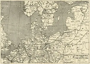
The North Sea and The Baltic Sea, 1915. Creator: UnknownThe North Sea and The Baltic Sea, 1915. The Netherlands remained neutral during World War I but following the Race to the Sea, both sides dug fortified trenches
General map of Estonia and Latvia. (Atlas de la Livonie), 1798. Private Collection
Land taken by Germany from Russia, First World War, 1915, (c1920). Creator: UnknownLand taken by Germany from Russia, First World War, 1915, (c1920). The Germanic Slice out of Russian Territory to the end of the Summer Campaign of 1915...territory gained by the Germans
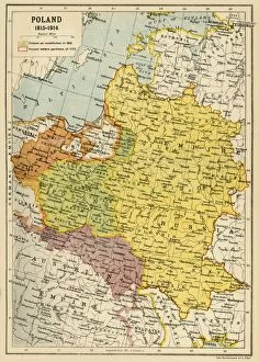
Poland, 1815-1914, (c1920). Creator: John Bartholomew & SonPoland, 1815-1914, (c1920). Map showing Polish territory from the end of the 18th century until the First World War: Poland as constituted in 1815, and Poland before partition of 1772
German battery attack from the beach at Eckernforde, 5 April 1849, (1936). Creator: UnknownGerman battery attack from the beach at Eckernforde, 5 April 1849, (1936). Deutsche Strandbatterien Bei Eckernforde, 5 April 1849
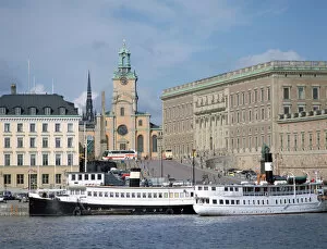
Harbor, Stockholm, Sweden, 1901. Creator: Keystone View CompanyHarbor, Stockholm, Sweden, 1901. Ships at the port of Stockholm, where Lake Malaren where flows out into the Baltic Sea. Stereocard. [Keystone View Company, USA, 1901]
The naval Battle of Oland on 26 July 1789. Creator: Cumelin, Johan Petter (1764-1820)The naval Battle of Oland on 26 July 1789. Found in the Collection of Sjohistoriska museet
First Russo-Swedish Battle of Rochensalm on August 24, 1789, c. 1790. Creator: SchoultzFirst Russo-Swedish Battle of Rochensalm on August 24, 1789, c. 1790. Found in the Collection of Sjohistoriska museet
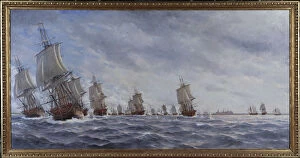
Second Russo-Swedish Battle of Svensksund on 10 July 1790. Creator: Schoultz, Johan TietrichSecond Russo-Swedish Battle of Svensksund on 10 July 1790. Found in the Collection of Sjohistoriska museet
The naval Battle of Oland on 26 July 1789, c. 1790. Creator: Cumelin, Johan Petter (1764-1820)The naval Battle of Oland on 26 July 1789, c. 1790. Found in the Collection of Sjohistoriska museet
The naval Battle of Reval on 13 May 1790. Creator: Hagg, Jacob (1839-1931)The naval Battle of Reval on 13 May 1790. Found in the Collection of Sjohistoriska museet
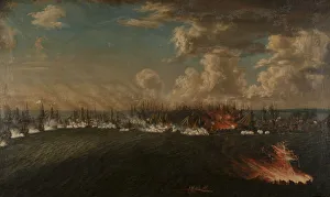
The Battle of Vyborg Bay on July 3, 1790, 1791. Creator: Schoultz, Johan Tietrich (1754-1807)The Battle of Vyborg Bay on July 3, 1790, 1791. Found in the Collection of Sjohistoriska museet
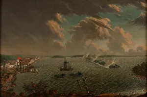
The Battle of Fredrikshamn on May 1790, 1791. Creator: Schoultz, Johan Tietrich (1754-1807)The Battle of Fredrikshamn on May 1790, 1791. Found in the Collection of Sjohistoriska museet
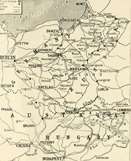
The Eastern Frontier, 1919. Creator: London Geographical InstituteThe Eastern Frontier, 1919. Map showing parts of Germany, Prussia, Russia and Austria during the First World War, 1914-1919, with fortified towns and main railway lines indicated
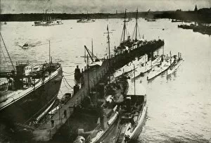
Kiel Harbour, (1919). Creator: UnknownKiel Harbour, (1919). View of the port of Kiel in Germany during the First World War, 1914-1919: The headquarters of the German Navy contains the Imperial shipbuilding yards, slips
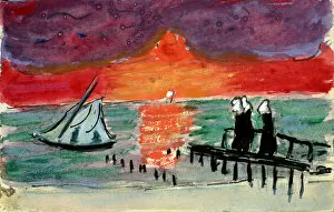
Baltic Sea, 1910s. Artist: Verefkin, Marianne, von (1860-1938)Baltic Sea, 1910s. Found in the collection of the Museo Communale d Arte Moderna, Ascona
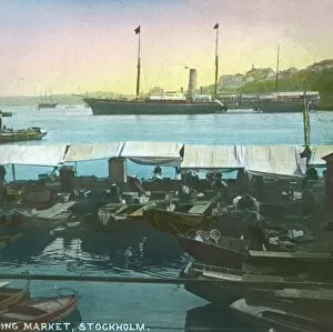
Floating Market, Stockholm, Sweden, late 19th-early 20th century. Creator: Fradelle & YoungFloating Market, Stockholm, Sweden, late 19th-early 20th century. Market stalls on board boats in the harbour of Swedens capital city. Glass lantern slide
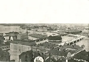
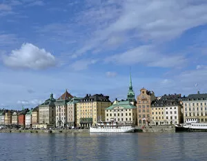
Panorama of Stockholm, Sweden, 1895. Creator: Axel LindahlPanorama of Stockholm, Sweden, 1895. Ships at the port of Stockholm, where Lake Malaren where flows out into the Baltic Sea
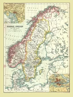
Map of Norway and Sweden, 1902. Creator: UnknownMap of Norway and Sweden, 1902. Norway, Sweden and the Baltic Sea, with insets of Copenhagen and Stockholm. From The Century Atlas of the World. [John Walker & Co, Ltd. London, 1902]
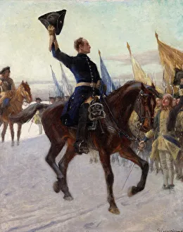
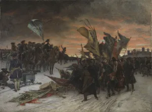
Charles XII greets his Caroleans, 1923. Private Collection
Gamla Stan, Stockholm, Sweden. Gamla Stan is the old town of Stockholm
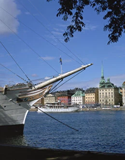
AF Chapman sailing ship (youth hostel), Stockholm, Sweden. Gamla Stan, the old town of Stockholm, can be seen in the background
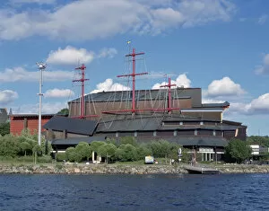
Vasa Museum, Djurgarden, Stockholm, Sweden. Built in 1990, the Vasa Museum is a maritime museum that houses the reconstructed Swedish warship the Vasa, which sank on her maiden voyage in 1628
Royal Palace, Stockholm, Sweden. The official residence of the Swedish monarch, Stockholm Palace was built in Baroque style between 1697 and 1760. The architect was Nicodemus Tessin the Younger
The Russo-Swedish seabattle of Krasnaya Gorka near Kronstadt on May 1790, 1790. Private Collection
Narva, 1905. Found in the collection of Nationalmuseum Stockholm
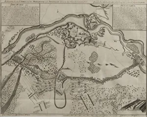
Map of the Battle at Narva, 1700. Private Collection
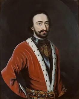
Prince Alexander Archilovich of Imereti (1674-1711), Early 18th cen. Found in the Collection of Nationalmuseum Stockholm