mail_outline sales@mediastorehouse.com
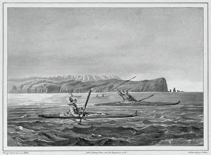
Inhabitants of Ounalacheka with their canoes (Aleutian Islands), 19th century. One of 65 lithographs that were included in the volume of maps published after the round-the-world voyage of
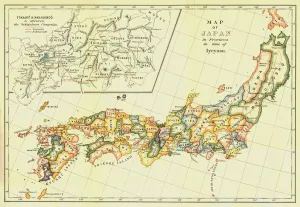
Map of Japan in Provinces in time of Iyeyasu, 1903. Creator: UnknownMap of Japan in Provinces in time of Iyeyasu, 1903. Tokugawa Ieyasu (1543-1616) first shogun of the Tokugawa shogunate which ruled Japan from 1600-1868 and is known as the Edo period
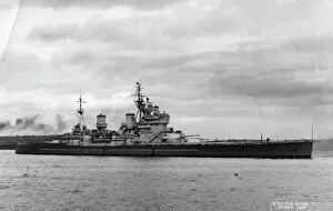
British battleship HMS King George V, Sydney, Australia, 1945. King George V after arriving from Tokyo where she had been present at the surrender of Japan
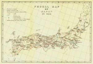
Feudal Map of Japan in 1615, (1903). Creator: UnknownFeudal Map of Japan in 1615, (1903). The feudal period of Japanese history was a time when powerful families (daimyo) and military warlords (shogun) ruled Japan
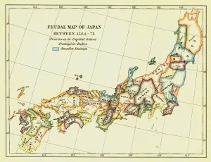
Feudal Map of Japan between 1564 -73, (1903). Creator: UnknownFeudal Map of Japan between 1564 -73, (1903). The feudal period of Japanese history was a time when powerful families (daimyo) and military warlords (shogun) ruled Japan
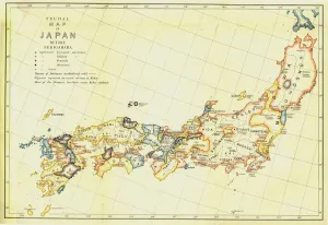
Feudal Map of Japan before Sekigahara, 1903. Creator: UnknownFeudal Map of Japan before Sekigahara, 1903. The feudal period of Japanese history was a time when powerful families (daimyo) and military warlords (shogun) ruled Japan
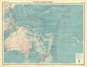
Map of the South Pacific Ocean. Map showing the Philippines, Indonesia, Papua New Guinea, Australia and New Zealand, and Pacific islands. Plate 102 from The Times Atlas
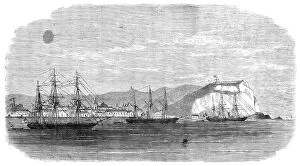
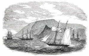
The Spanish iron-clad frigate Numancia in the harbour of Callao, 1865. Creator: UnknownThe Spanish iron-clad frigate Numancia in the harbour of Callao, 1865. Engraving of a drawing by Clement Penny of H.M.S. Leander
The Railway Station, Arica, Peru, 1865. Creator: UnknownThe Railway Station, Arica, Peru, 1865. View from a sketch by Mr. J. N. Dutton '...of H.M.S. Shearwater, when lying in that harbour of the Pacific coast
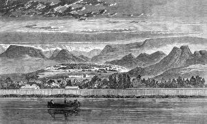
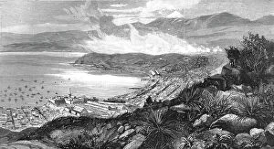
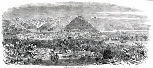
View of Arica, Peru, 1865. Creator: UnknownView of Arica, Peru, 1865. 'As the seaport town of Arica, near the southern extremity of Peru, was lately the head-quarters
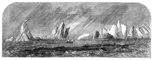
The Great Britain among icebergs near Cape Horn, 1864. Creator: UnknownThe Great Britain among icebergs near Cape Horn, 1864. The screw-steamer Great Britain, which arrived at Liverpool...having made the passage from Melbourne in the short period of sixty-one days
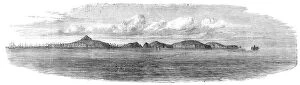
General view of the Chincha Islands, lately seized by the Spaniards, 1864. Creator: UnknownGeneral view of the Chincha Islands, lately seized by the Spaniards, 1864. Engraving from a sketch by Oswald Younghusband
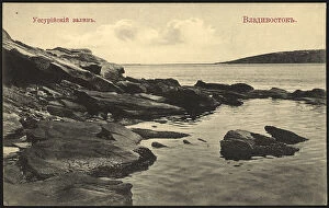
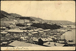
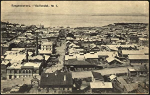
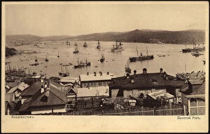
Vladivostok. Ussuri Bay, 1904-1917. Creator: UnknownVladivostok. Ussuri Bay, 1904-1917. National Library of Russia
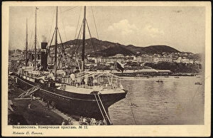
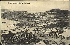
Vladivostok. Commercial marina, 1904. Creator: UnknownVladivostok. Commercial marina, 1904. National Library of Russia
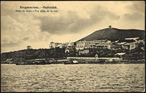
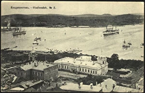
Vladivostok. View from the sea, 1904. Creator: UnknownVladivostok. View from the sea, 1904. National Library of Russia
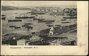
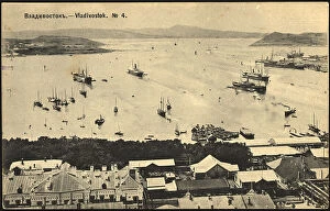
Vladivostok, 1904. Creator: UnknownVladivostok, 1904. National Library of Russia
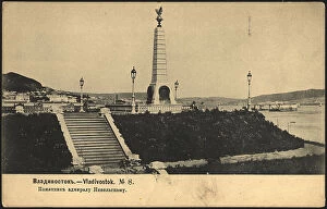
Vladivostok. Monument to Admiral Nevelsky, 1904-1917. Creator: UnknownVladivostok. Monument to Admiral Nevelsky, 1904-1917. National Library of Russia
Vladivostok, 1904-1909. Creator: UnknownVladivostok, 1904-1909. National Library of Russia
Vladivostok. Golden Horn, 1904. Creator: UnknownVladivostok. Golden Horn, 1904. National Library of Russia
In the Vladivostok port, 1929. Creator: UnknownIn the Vladivostok port, 1929. In the early part of the Stalin era, the Kremlin established a new administrative territory in the Soviet Far East--the Jewish Autonomous Region--to serve as a Jewish
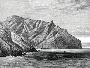
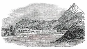
Sketches from H.M.S. Challenger, by Mr. J. J. Wild: the Challenger in Cumberland Bay, ...1876. Creator: John GreenawaySketches from H.M.S. Challenger, by Mr. J. J. Wild: the Challenger in Cumberland Bay, Juan Fernandez, 1876....the Island of Juan Fernandez
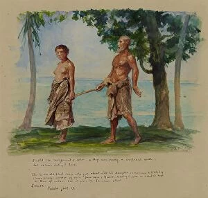
Blind Man and His Daughter, Vaiala, Samoa, 1890. Creator: John La FargeBlind Man and His Daughter, Vaiala, Samoa, 1890
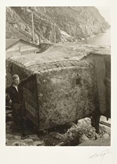
Northwest Coast, c.1927. Creator: Edward Sheriff CurtisNorthwest Coast, c.1927. Man standing next to shelter of Northwest Coast Indians. From The North American Indian by Edward S. Curtis
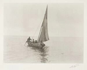
Northwest Coast, c.1927. Creator: Edward Sheriff CurtisNorthwest Coast, c.1927. Indians in boat
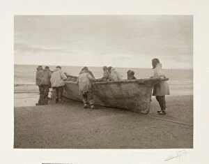
Northwest Coast, c.1927. Creator: Edward Sheriff CurtisNorthwest Coast, c.1927. Indians launching a boat
Pitcairn's Island - sketched from H.M.S. "Amphitheatre", 1856. Creator: UnknownPitcairn's Island - sketched from H.M.S. "Amphitheatre", 1856. Visit to an island in the Pacific Ocean inhabited by descendants of the Bounty mutineers
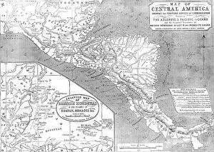
Map of Central America shewing the Proposed Routes of Communication between the Atlantic & Pacific O CreatorMap of Central America shewing the Proposed Routes of Communication between the Atlantic & Pacific Oceans, 1856....and the Disputed Territories of British Honduras (Belize)
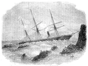
Wreck of the Chilian Steamer "Cazador", 1856. Creator: Smyth. Wreck of the Chilian SteamerWreck of the Chilian Steamer "Cazador", 1856. Disaster off the coast of Chile. The vessel left Talcahuano with a smooth sea
Une vue des cotes coralliennes de l'Australie; Les Terres Du Pacifique, 1914. Creator: UnknownUne vue des cotes coralliennes de l'Australie; Les Terres Du Pacifique, 1914. From "Grande Geographie Bong Illustree", 1914
View of the Fort of Acapulco, Mexico, 1854. Creator: UnknownView of the Fort of Acapulco, Mexico, 1854. From "Cassells Illustrated Family Paper; London Weekly 31/12/1853 - 30/12/1854"
The Opening of the New Route to India by the Canadian Pacific Railway, 1891. Creator: UnknownThe Opening of the New Route to India by the Canadian Pacific Railway; showing the "Empress of India" passing through "Lions Gate, " Vancouver, 1891, 1891. From "The Graphic
Valparaiso, Chile, from the Hills South-East of the City, 1891. Creator: UnknownValparaiso, Chile, from the Hills South-East of the City, 1891. From "The Graphic. An Illustrated Weekly Newspaper", Volume 44. July to December, 1891
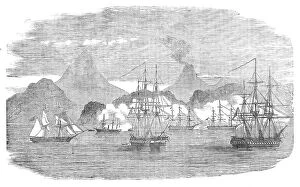
Naval Attack on the Russian Fort of Petropaulovski, 1854. Creator: UnknownNaval Attack on the Russian Fort of Petropaulovski, [Kamchatka], 1854. Crimean War. French and English warships: L'Obligator; Virago; Eurydice
San Francisco - General View, 1850. Creator: UnknownSan Francisco - General View, 1850. Engraving from a Daguerreotype, showing...the Bay of San Francisco [which is] is of difficult navigation, on account of the winds, and fogs and adverse currents
San Francisco, from the south-west, 1850. Creator: UnknownSan Francisco, from the south-west, 1850. Growth of the town of San Francisco, USA, during the Gold Rush: We have taken a room here...for which we pay fifty dollars a month (£10)
Tigre Island, 1850. Creator: UnknownTigre Island, [now in Honduras], 1850. From "Illustrated London News", 1850. Sketch by "a Traveller in Central America"...of...the interior of the island
The Northernmost Chincha (Guano) Island, 1850. Creator: UnknownThe Northernmost Chincha (Guano) Island, [Peru], 1850. Sketch by "a Traveller in Central America". In 1840 attention was first drawn to guano for the purposes of agriculture in Europe
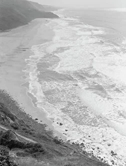
Near Half Moon Bay, California coast, 1938. Creator: Dorothea LangeNear Half Moon Bay, California coast. Artichokes are grown along here
Artichokes are grown along here, near Half Moon Bay, California coast, 1938. Creator: Dorothea LangeNear Half Moon Bay, California coast. Artichokes are grown along here
Artichoke farms reach to the water's edge, near Half Moon Bay, California coast, 1938. Creator: Dorothea LangeNear Half Moon Bay, California coast. Artichoke farms reach to the water's edge
Near Half Moon Bay, California coast, 1938. Creator: Dorothea LangeNear Half Moon Bay, California coast. Artichoke farms reach to the water's edge
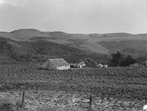
Artichoke ranch, near Half Moon Bay, California, November 14, 1938. Creator: Dorothea LangeNovember 14, 1938. Near Half Moon Bay, California. Artichoke ranch
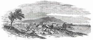
View of Kodiak, between c1900 and 1923. Creator: UnknownView of Kodiak, between c1900 and 1923
Transferring of Cargo along the Shore, 1889. Creator: UnknownTransferring of Cargo along the Shore, 1889. From a collection consisting of an album and individual photographs that document the Arctic voyage in 1889 of the clipper ship Razboinik (Pirate)