mail_outline sales@mediastorehouse.com
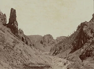
Phantom Ridge, Black Hills, Dak, 1890. Creator: John C. H. GrabillPhantom Ridge, Black Hills, Dak, 1890. Showing horse-drawn coach making its way down a dry riverbed, surrounded by steep ridges and rock formations
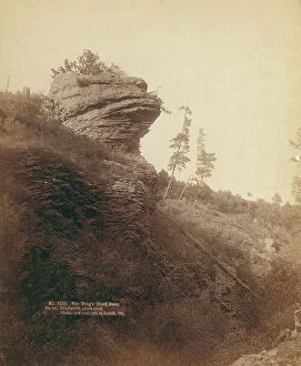
The Frog's Head Rock On old Deadwood stage road, 1890. Creator: John C. H. GrabillThe Frog's Head Rock On old Deadwood stage road, 1890. Rock formation resembling a frog's head
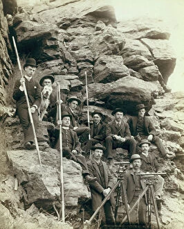
Deadwood Central RR Engineer Corps, 1888. Creator: John C. H. GrabillDeadwood Central RR Engineer Corps, 1888. Outdoor group portrait of ten railroad engineers and a dog, posing with surveyors transits on tripods and measuring rods, on the side of a mountain
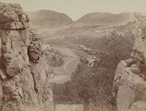
Echo Canyon Looking through Sioux Pass On FE and MV Ry, Hot Springs, SD, 1891. Creator: John C. H. GrabillEcho Canyon Looking through Sioux Pass On FE and MV Ry, Hot Springs, SD, 1891. House and road in plains area as seen from above and between two large rock formations; mountains in distance
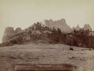
Crow Butte Near Ft Robinson, Neb and FE & MV RR -- In battle, the Indians drove the "Crows" up on the mountain and camped on the only approach
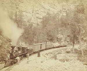
Giant Bluff Elk Canyon on Black Hills and Ft P RR, 1890. Creator: John C. H. GrabillGiant Bluff Elk Canyon on Black Hills and Ft P RR, 1890. A wood-burning locomotive with four cars, on a track below a cliff; several people are posing in front of the train
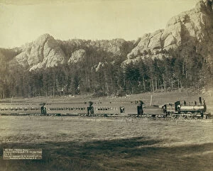
Giant Bluff Elk Canyon on Black Hills and Ft P RR, 1890. Creator: John C. H. GrabillGiant Bluff Elk Canyon on Black Hills and Ft P RR, 1890. A two-car train in front of a steep cliff; several passengers are posing in front of the train
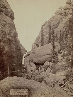
Our picnic party at Sunday Gulch Photographed between the walls of the grandest mountain... 1891. Creator: John C. HOur picnic party at Sunday Gulch Photographed between the walls of the grandest mountains of the Dakotas, near Custer City on the B & M Ry, 1891
Harney Range Horseshoe Curve on the B[urlington] and M[issouri River] Ry near Custer City, SD, 1891. Creator: John CHarney Range Horseshoe Curve on the B[urlington] and M[issouri River] Ry near Custer City, SD, 1891. Full view of train in a valley with mountains in background
Ural Mountains. Taiga in the Zlatoust Region, 1904. Creator: Boris Vasilievich SmirnovUral Mountains. Taiga in the Zlatoust Region, 1904. Boris Vasilievich Smirnov (1881-1954) was a Russian artist who in 1904 traveled by prisoner transport from western Russia across Siberia
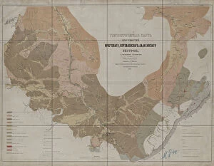
Geognostic Map of the Localities of Irkutsk, Verkholensk, and Balagansk Districts, 1873. The first geological (geognostic) maps in Russia were produced in the 1850s
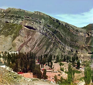
Village of Nizhnii Gunib in Dagestan, between 1905 and 1915. Creator: Sergey Mikhaylovich Prokudin-GorskyVillage of Nizhnii [or Nizhny] Gunib in Dagestan, between 1905 and 1915. {/33310/}, leader of the Chechen and Daghestani tribes, made his last stand against the Russians at Ghunib
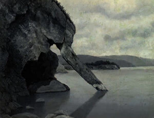
Cliff "Trunk" and Shaman's Rock, 1880-1897. Creator: Pavel Mikhailovich KosharovCliff "Trunk" and Shaman's Rock, 1880-1897. From a collection of paintings, lithographs, sketches, studies, and drawings
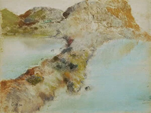
Rocky coast, about 1890/1892. Creator: Edgar DegasRocky coast, about 1890/1892
The River Irtysh Between the Fortress of Bukhtarminsk and the Town of Ust'-Kamenogorsk, 1880-1897. From a collection of paintings, lithographs, sketches, studies, and drawings
The island of St. Paul in the Indian Ocean, undated. (c1850s) Creator: Joseph SellenyThe island of St. Paul in the Indian Ocean, undated. (c1850s)
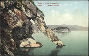
"Khabit" (Khobot) Rock and the Shaman's Stone at 4 Versts From the Village of Kaltuk... 1850-1899"Khabit" (Khobot) Rock and the Shaman's Stone at 4 Versts From the Village of Kaltuk- Lake Baikal, 1850-1899
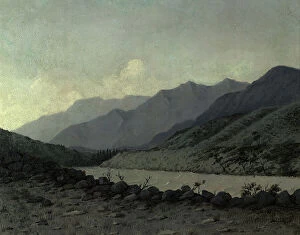
Crossing Over the River Katun Above Angudaia. View From the North. Altai, 1850-1899. From a collection of paintings, lithographs, sketches, studies, and drawings
Mountain Landscape. Altai, 1850-1899. Creator: Pavel Mikhailovich KosharovMountain Landscape. Altai, 1850-1899. From a collection of paintings, lithographs, sketches, studies, and drawings, which capture various remote corners of the Siberian wilderness
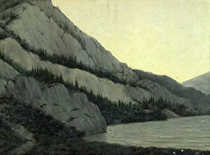
View of the Katun River Valley, 1850-1899. Creator: Pavel Mikhailovich KosharovView of the Katun River Valley, 1850-1899. From a collection of paintings, lithographs, sketches, studies, and drawings, which capture various remote corners of the Siberian wilderness
Jasper quarry on the Korgon River, 1880-1897. Creator: Pavel Mikhailovich KosharovJasper quarry on the Korgon River, 1880-1897. From a collection of paintings, lithographs, sketches, studies, and drawings, which capture various remote corners of the Siberian wilderness
White Bom on the Chu River View From the South West Altai, 1880-1897. Creator: Pavel Mikhailovich KosharovWhite Bom on the Chu River View From the South West Altai, 1880-1897. From a collection of paintings, lithographs, sketches, studies, and drawings
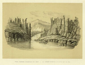
The Stolbovka Flowing into the Lena River, 1856. Creator: Ivan Dem'ianovich BulychevThe Stolbovka Flowing into the Lena River, 1856. From Puteshestviye po Vostochnoy Sibiri I. Bulychova. Chast 1-ya. Poyezdka v Kamchatku (A journey across eastern Siberia: Part 1, Trip to Kamchatka)
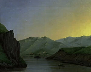
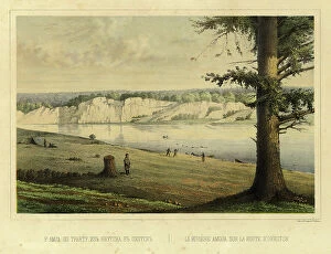
The Amga River on the Route from Yakutsk to Okhotsk, 1856. Creator: Ivan Dem'ianovich BulychevThe Amga River on the Route from Yakutsk to Okhotsk, 1856. From Puteshestviye po Vostochnoy Sibiri I. Bulychova. Chast 1-ya
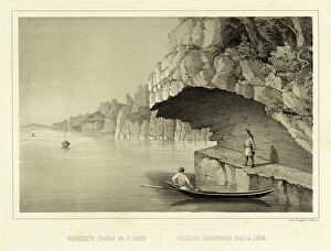
Cliff Overhang Above the Lena River, 1856. Creator: Ivan Dem'ianovich BulychevCliff Overhang Above the Lena River, 1856. From Puteshestviye po Vostochnoy Sibiri I. Bulychova. Chast 1-ya. Poyezdka v Kamchatku (A journey across eastern Siberia: Part 1, Trip to Kamchatka)
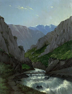
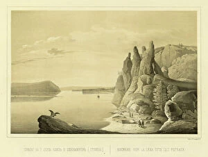
View of the Lena River at Ursk Gate, 1856. Creator: Ivan Dem'ianovich BulychevView of the Lena River at Ursk Gate, 1856. From Puteshestviye po Vostochnoy Sibiri I. Bulychova. Chast 1-ya. Poyezdka v Kamchatku (A journey across eastern Siberia: Part 1, Trip to Kamchatka)
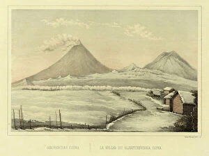
Klyuchevskoi Volcano, 1856. Creator: Ivan Dem'ianovich BulychevKlyuchevskoi Volcano, 1856. From Puteshestviye po Vostochnoy Sibiri I. Bulychova. Chast 1-ya. Poyezdka v Kamchatku (A journey across eastern Siberia: Part 1, Trip to Kamchatka)
Lake Baikal, rock and excavation near the pier of Mysovaya station, 1904-1917. Creator: UnknownLake Baikal, rock and excavation near the pier of Mysovaya station, 1904-1917. National Library of Russia
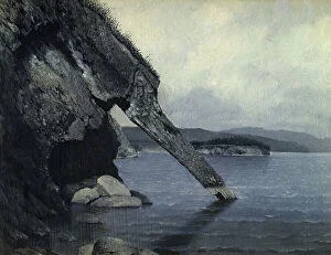
"Trunk" rock on Lake Baikal, 1904-1917. Creator: Unknown. "Trunk" rock on Lake Baikal, 1904-1917"Trunk" rock on Lake Baikal, 1904-1917. National Library of Russia
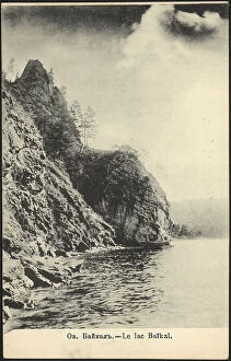
Lake Baikal, 1904-1914. Creator: UnknownLake Baikal, 1904-1914. This postcard is from the "Lake Baikal" series. National Library of Russia
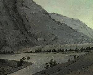
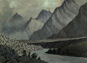
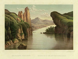
Cliffs (the Pillars) Above the Lena River near the City of Olekminsk, 1856. Creator: Ivan Dem'ianovich BulychevCliffs (the Pillars) Above the Lena River near the City of Olekminsk, 1856. From Puteshestviye po Vostochnoy Sibiri I. Bulychova. Chast 1-ya
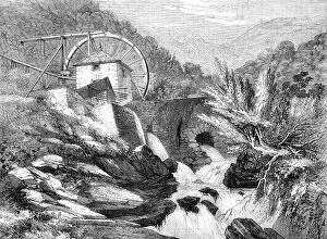
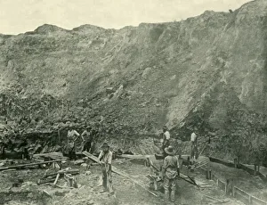
The Vigra Gold Mines, North Wales: the Crushing Mill, 1862. Creator: UnknownThe Vigra Gold Mines, North Wales: the Crushing Mill, 1862. The Vigra gold mines are situated in a most picturesque and mountainous range in the parish of Llanabar
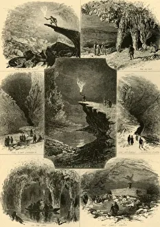
Scenes in Mammoth Cave, 1874. Creator: Alfred WaudScenes in Mammoth Cave, 1874. Tourists visit limestone caverns in Kentucky, USA, the longest cave system known in the world: The Lovers Leap; The Altar; The Star Chamber; The Dead Sea; The Vestibule
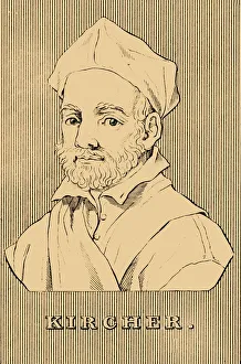
Kircher, (1602-1680), 1830. Creator: UnknownKircher, (1602-1680), 1830. Athanasius Kircher (1602-1680) German Jesuit scholar and polymath who published works on comparative religion, geology, and medicine
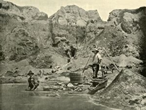
Gold Miners Near Beechworth, 1901. Creator: UnknownGold Miners Near Beechworth, 1901. Beechworth in the north-east of Victoria, Australia, saw major growth during the gold rush of the mid-1850s. From " Federated Australia"
Gold Diggers at Work near Beechworth, Victoria, 1901. Creator: UnknownGold Diggers at Work near Beechworth, Victoria, 1901. Beechworth in the north-east of Victoria, Australia, saw major growth during the gold rush of the mid-1850s
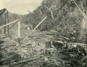
Granite Quarries, Trawool, Victoria, 1901. Creator: UnknownGranite Quarries, Trawool, Victoria, 1901. Trawool in central Victoria, on the middle reaches of the Goulburn River, first explored by Hume and Hovell in 1824, was later settled as a sheep station
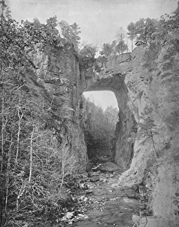
Natural Bridge, Virginia, c1897. Creator: UnknownNatural Bridge, Virginia, c1897. Natural arch in limestone gorge of Cedar Creek in Rockbridge County, Virginia purchased by Thomas Jefferson from King George III of England for 20 shillings in 1774
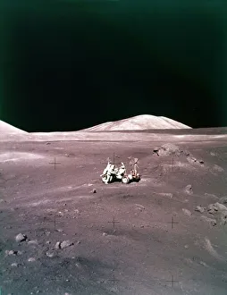
The Taurus-Littrow landing site, Apollo 17 mission, December 1972. Creator: NASAThe Taurus-Littrow landing site, Apollo 17 mission, December 1972. US astronauts Eugene Cernan and Harrison Schmitt collected samples and drove the Lunar Roving Vehicle on the Moon
Meeting of the British Association at Birmingham:..a paper on the geology of the district, 1865. Creator: UnknownMeeting of the British Association at Birmingham: the secretary of the Valley Field Club reading a paper on the geology of the district, 1865. Hunger and thirst level all distinctions
A Canon; A Ride Round the Valley of Mexico, 1875. Creator: Frederick A. LyonsA Canon; A Ride Round the Valley of Mexico, 1875. From, Illustrated Travels by H.W. Bates. [Cassell, Petter, and Galpin, c1880, London] Belle Sauvage Works.London E.C
South-western Colorado, 1940. Creator: Russell LeeSouth-western Colorado
View of the Alpes, 1760. Creator: Jean OuvrierView of the Alpes, 1760
First View of the Surroundings of Naples, ca. 1776. Creator: Pierre Francois BasanFirst View of the Surroundings of Naples, ca. 1776
The Calm, ca. 1750-1790. Creator: Elisabeth Cousinet LempereurThe Calm, ca. 1750-1790
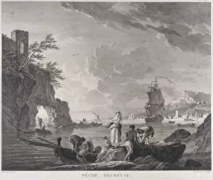
Happy Fishing, ca. 1760. Creator: Adrian ZinggHappy Fishing, ca. 1760
The Bathers, ca. 1760. Creator: UnknownThe Bathers, ca. 1760
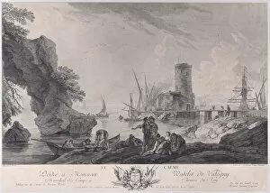
Harbor Scene, ca. 1764. Creator: Franz Edmund WeirotterHarbor Scene, ca. 1764